News update February 2025

Get the most out of UNI-Collect The new year has begun, and at MarXact, we’re moving full speed ahead! In this edition, we introduce a convenient new feature: the ability to survey multiple layers at once. We also have great news regarding support—our team is growing with the arrival of Sam and Rodrigo, who will […]
News update Januari 2025

Switch to UNI-Collect The new year is already underway, and at marXact, we’re moving forward with full speed ahead. This month at marXact is all about the switch to UNI-Collect, the successor to UNI-Connect. Want to know everything about this new measurement app and how to make the transition smoothly? Then visit us this week […]
Happy Holidays!

The holidays are just around the corner! ✨ As the year draws to a close, we at marXact want to extend our warmest wishes for a nice holiday season and a happy New Year! We hope you enjoy this special time with loved ones, creating memories and enjoying some well-deserved rest. We are ready to […]
News Update – August & September 2024

Ready to survey in a changing energy landscape? As summer winds down, we’re excited to share our latest updates with you! Are you ready for the energy transition? Discover how marXact can effortlessly help you meet the demands of grid operators in this late-summer edition of our newsletter. Not just for the energy transition. Whatever […]
News Update – May 2024

Measure with Tilt & iOS UNI-Collect Get ready for some springtime excitement with our latest updates for 2024! We will take a closer look at the much-awaited Tilt function for our UNI-GR2 RTK GNSS receiver and the release of the iOS beta version of UNI-Collect. Wanna be among the first to test out? Read on! […]
What is Surveying?

What is Surveying Surveying, an ancient practice, has shaped civilizations and continues to be vital in modern times. From establishing the boundaries of kingdoms and making the construction of miracles possible, to forming the basis of modern urbanism and infrastructure. From the pyramids of Egypt to the impressive skylines of today, behind every great construction […]
What types of land surveying techniques exists?

What Types of Land Surveying exists? When starting a new project, understanding the terrain is often the key to success. Whether it’s a construction project, a real estate development, or an environmental conservation initiative, the foundation of success lies in precise and comprehensive surveying. Within the world of surveying, various methodologies are employed, each vital […]
How can you determine the property boundary?
Determining the exact location of your property boundary is important for every landowner. Knowing where your property begins and ends is not only important for maintaining good relationships with your neighbors, but also for correctly carrying out renovations, plantings, or other modifications to your land. In this article, we delve deep into the world of […]
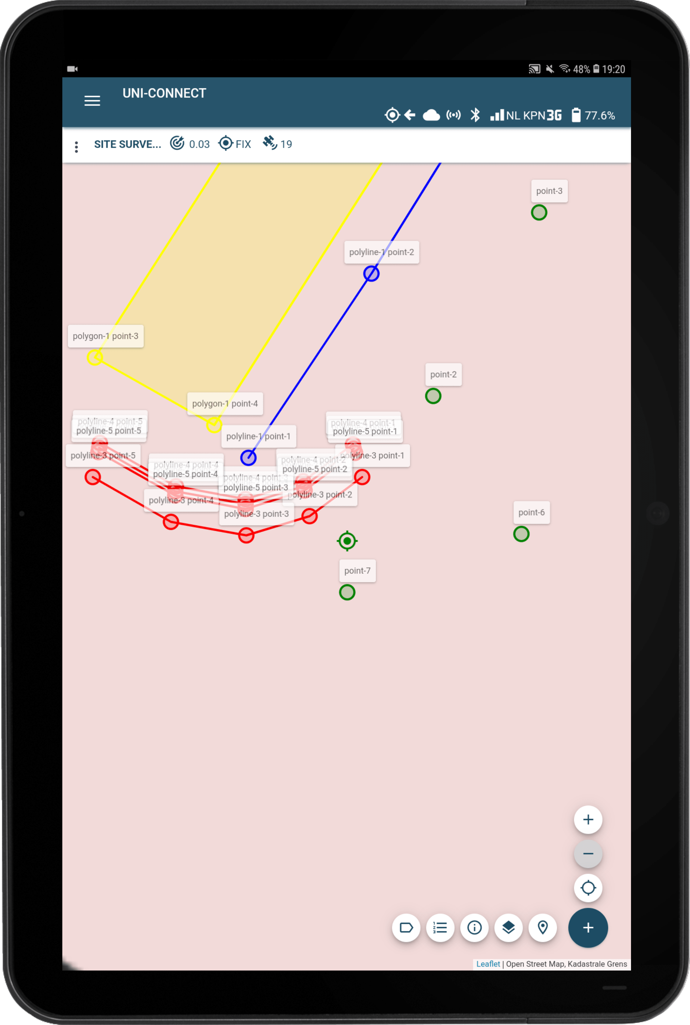
Feature Friday – UNI-Cloud Survey projects essentials for your experience

We have made it our mission to make digital surveying available to every field worker out there. To create the best possible personalized surveying experience for all of them, with handy tips and tricks, connections with other apps or software, and new feature releases frequently. We’re going to combine these releases and updates and how […]
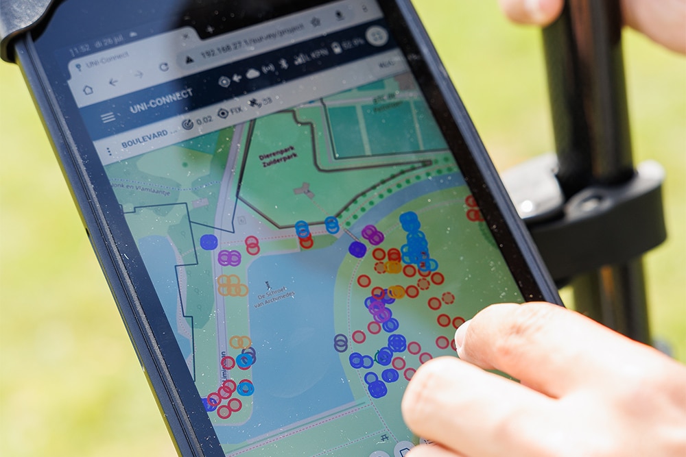
Greenpoint & marXact

Greenpoint is an online platform for managing the outdoor space. Companies, municipalities, and contractors can get data about objects in the outdoor area with their software. Greenpoint ables you to record the information and access it very easy in map images that provide visual recognition. With the BOR-solution you can collect and manage all your […]