Nieuws update februari 2025

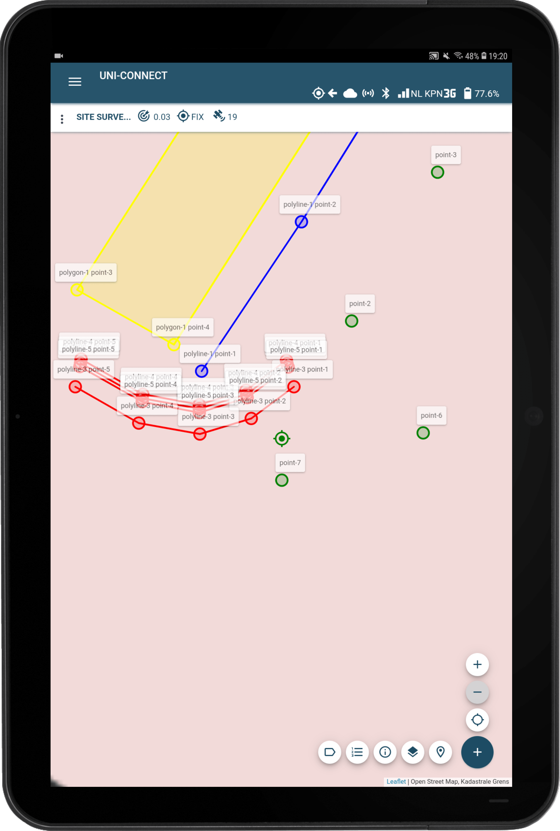
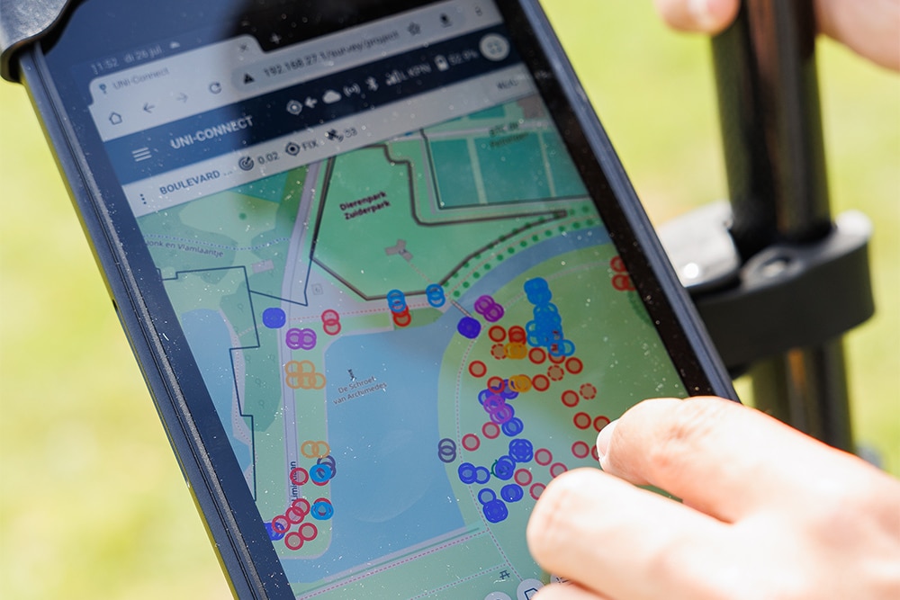
Haal het meeste uit UNI-Collect Het nieuwe jaar is begonnen en MarXact draait op volle toeren! In deze editie introduceren we een handige nieuwe functie: de mogelijkheid om meerdere lagen tegelijk te onderzoeken. We hebben ook geweldig nieuws op het gebied van ondersteuning - ons team groeit met de komst van Sam en Rodrigo, die [...]
Nieuws update januari 2025

Overstappen naar UNI-Collect Het nieuwe jaar is alweer onderweg, en bij marXact gaan we met volle vaart vooruit. Deze maand staat bij marXact in het teken van de overstap naar UNI-Collect, de opvolger van UNI-Connect. Wil je alles weten over deze nieuwe meetapp en hoe je de overstap soepel kunt laten verlopen? Bezoek ons dan deze week [...]
Fijne feestdagen!

De feestdagen staan voor de deur! ✨ Nu het jaar ten einde loopt, willen we bij marXact onze hartelijke wensen uitspreken voor fijne feestdagen en een gelukkig Nieuwjaar! We hopen dat u geniet van deze speciale tijd met uw dierbaren, herinneringen creëert en geniet van wat welverdiende rust. We zijn klaar om [...]
Nieuws - Augustus & September 2024

Klaar om te onderzoeken in een veranderend energielandschap? Nu de zomer ten einde loopt, willen we graag onze laatste updates met u delen! Bent u klaar voor de energietransitie? Ontdek hoe je met marXact moeiteloos kunt voldoen aan de eisen van netbeheerders in deze nazomereditie van onze nieuwsbrief. Niet alleen voor de energietransitie. Wat [...]
Nieuws Update -Mei 2024

Meten met Tilt & iOS UNI-Collect Bereid je voor op de lente met onze laatste updates voor 2024! We gaan dieper in op de langverwachte kantelfunctie voor onze UNI-GR2 RTK GNSS ontvanger en de release van de iOS beta versie van UNI-Collect. Wil je als een van de eersten testen? Lees dan snel verder! [...]
Wat is landmeten?

Wat is landmeetkunde Landmeetkunde, een eeuwenoude praktijk, heeft beschavingen gevormd en is nog steeds van vitaal belang in de moderne tijd. Van het vaststellen van de grenzen van koninkrijken en het mogelijk maken van de bouw van wonderen, tot het vormen van de basis van moderne stedenbouw en infrastructuur. Van de piramides van Egypte tot de indrukwekkende skylines van vandaag, achter elke grote constructie [...]
Welke soorten landmetingen zijn er?

Welke soorten landmeetkunde bestaan er? Bij het starten van een nieuw project is inzicht in het terrein vaak de sleutel tot succes. Of het nu gaat om een bouwproject, een vastgoedontwikkeling of een initiatief voor milieubehoud, de basis voor succes ligt in nauwkeurig en uitgebreid landmeten. Binnen de landmeetkundige wereld worden verschillende methodes gebruikt, elk van vitaal belang [...]
Hoe kun je de erfgrens bepalen?
Het bepalen van de exacte locatie van de grens van je eigendom is belangrijk voor elke landeigenaar. Weten waar je eigendom begint en eindigt is niet alleen belangrijk voor het onderhouden van goede relaties met je buren, maar ook voor het correct uitvoeren van renovaties, beplantingen of andere aanpassingen aan je land. In dit artikel duiken we diep in de wereld van [...]
Feature Friday - Nieuwe projectenbenodigdheden voor de UNI-Cloud

We hebben het onze missie gemaakt om digitaal inmeten beschikbaar te maken voor elke veldwerker. Om de best mogelijke gepersonaliseerde landmeetervaring voor iedereen te creëren, met handige tips en trucs, koppelingen met andere apps of software en regelmatig nieuwe functies. We gaan deze releases en updates combineren en hoe [...]
Greenpoint & marXact

Greenpoint is een online platform voor het beheer van de buitenruimte. Bedrijven, gemeenten en aannemers kunnen met hun software gegevens krijgen over objecten in de buitenruimte. Greenpoint stelt je in staat om de informatie vast te leggen en zeer eenvoudig te benaderen in kaartbeelden die visuele herkenning bieden. Met de BOR-oplossing kunt u al uw [...]