
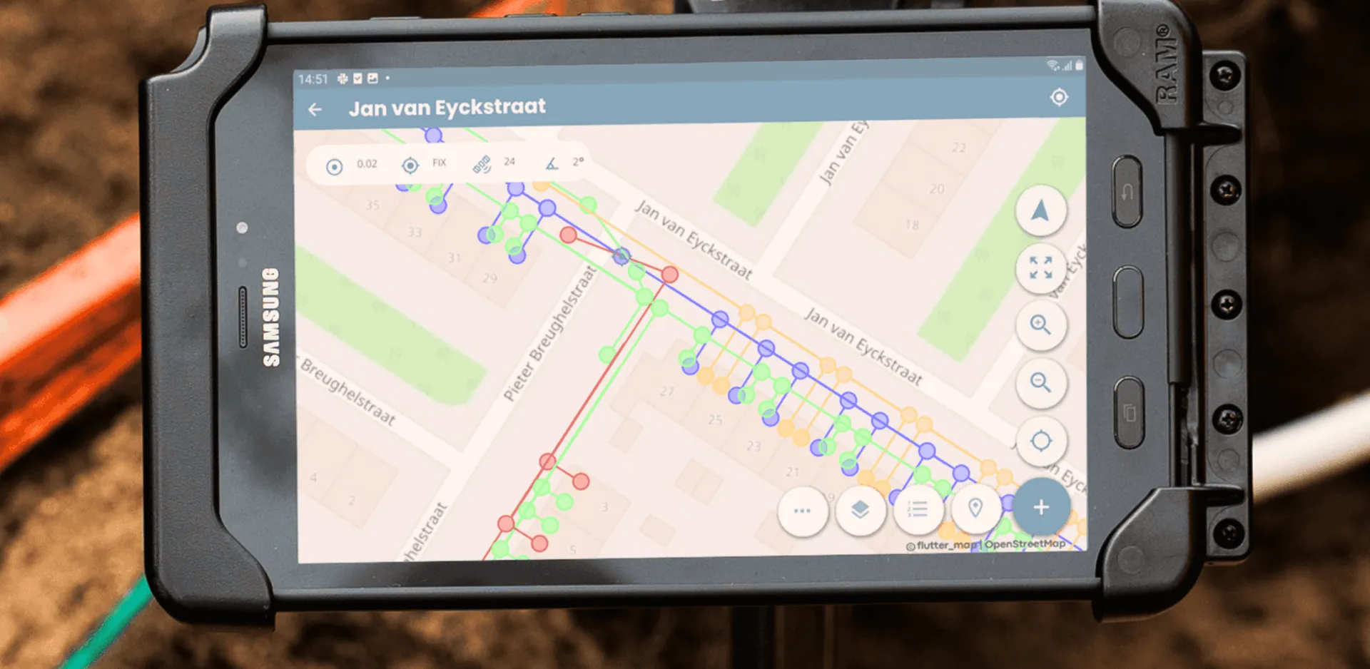
One surveying app for every phone, tablet and receiver
Works on iOS and Android, with the UNI-GR2 or any Bluetooth NMEA receiver. Start with the tablet you already carry.
Download the app
To experience how easy surveying can be!



Everything you need to survey, in one app
UNI-Collect is the field app of the marXact system. Set the project up once, then everyone on site works from the same drawing, the same layers and the same attributes.
- Record points, lines and areas
- Set out straight from your drawing
- Layers and attributes, set up once
- Length, area and volume
- Your own coordinate system per country
- Sync to UNI-Cloud in the background
Works with the UNI-GR2 and with any other Bluetooth NMEA receiver.
Pair the UNI-GR2 for centimetre-accurate RTK out of the box, or connect a receiver you already own over Bluetooth as long as it outputs NMEA. The app is the same either way.
The complete UNI-Collect Survey Package, receiver, tablet, app, cloud and corrections in one case, starts at .

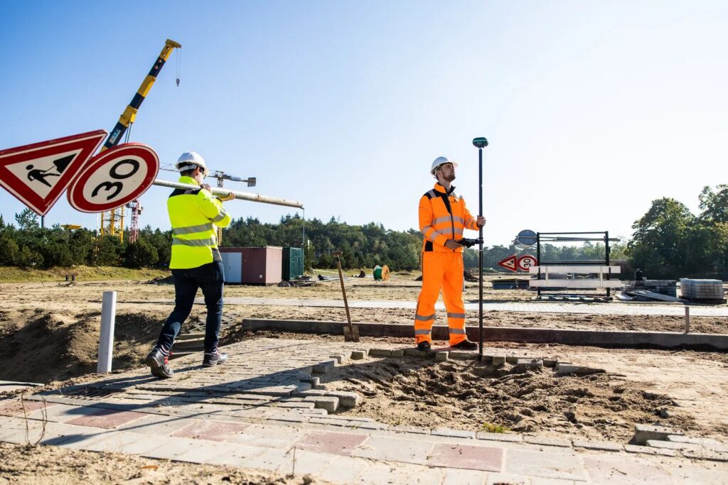
See it on a real site
We bring a receiver and a tablet to your own project and let your crew take the first measurement.
Trusted by 1000+ companies
More than 10 million objects measured, in more than 40 countries.








Why you should equip your teams
Surveying stops being a specialist job the moment the crew can do it themselves. Three things change on site.
Work faster and gather more data
One person measures and sets out without waiting for a surveyor to become available. Points that used to be skipped because they cost an extra visit now get recorded on the spot, so your as-built is complete the first time.
Cut cost and lower the chance of damage
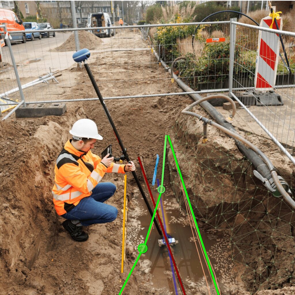
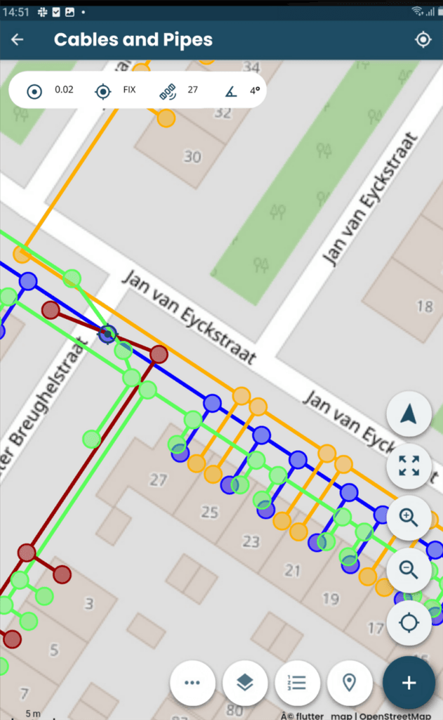
No hired surveyor per visit and no standing around while the site waits. In the Netherlands the KLIC cable viewer is included on every UNI-Cloud plan, so your crew sees where the cables and pipes run before the first spade goes in.
Fewer surprises in the ground
Load your existing drawings and background layers into the project before the crew arrives, so everyone works from the same picture of what is already there.
Work to the centimetre, every time
RTK corrections give a centimetre-accurate fix in the field. Everyone in the crew measures the same way, in the same coordinate system, against the same layers and attributes.
Cheaper than hiring it in, from the first year
One app for every discipline
From roads to fibre, utilities to green space: record and set out to the centimetre with the same app, on any site.



And much more.
- Sewer construction
- Road surveys
- Solar parks
- Municipalities
- Cadastral work
- Explosive ordnance surveys
- Architecture
- Recreation parks
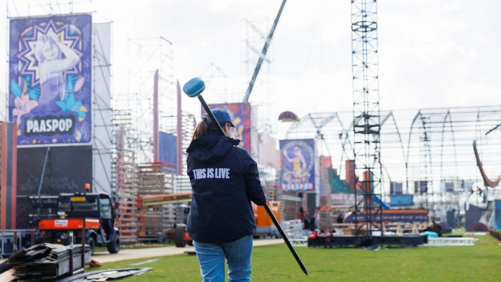
- Events and festivals
- Mussel farmers
Everything the app does, grouped
Measure, set out, scan in 3D, photograph and export, straight from the app. What is not there yet is marked as such.
Measure
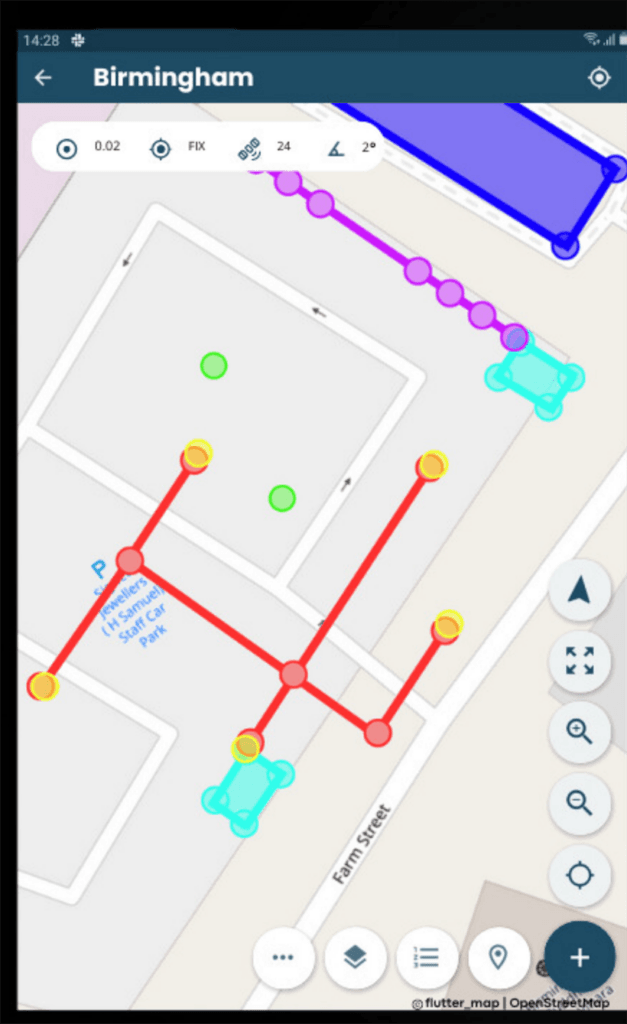
- Points, lines and areas.
- Offset points, offset lines and offset areas.
- Enter a point by hand.
- Averaging over a set recording time.
- Tilt compensation with the UNI-GR2.
- Your own pole height per point.
Set out
- Points, lines and areas.
- A direction arrow to the target point.
- Values to the centimetre.
- A warning when accuracy drops.
- Save what you set out, or update the existing point.
Layers and data
- Unlimited attributes.
- Layer groups.
- Labels on or off per layer.
- A coordinate system per country, with transformation grids on the tablet.
Background
- Cadastral lines for the Netherlands, Belgium and Germany.
- Set out inside an imported background layer.
- Inspect the objects in that layer.
Photos and 3D
- Photos on a point or a shape, with EXIF and bulk actions.
- Photos sync to UNI-Cloud on their own.
- LiDAR 3D scanning on iOS devices with LiDAR.
- Photos and scans land on the map on the centimetre, on the position of the UNI receiver, not on the tablet's own GPS.
Export and sync
- CSV, DWG, DXF and TXT straight from the app.
- Real-time sync.
- View, edit and delete your exports.
- Importing runs through UNI-Cloud, and the app links you there.
Coming soon: basic CAD drawing in UNI-Cloud. PDF reports are in the works.
KLIC notifications in the field and on the map
Your KLIC data sits in the same project as your measurements, in the field and in the office.
- KLIC viewer as a layer over your project in UNI-Cloud.
- Open and download KLIC documents from UNI-Cloud.
- Use imported GeoJSON as a KLIC layer.
- Use KLIC codes in UNI-Collect on the tablet.
- Also visible in UNI-Machine in the cabin.
KLIC layer available on every UNI-Cloud plan. Requesting and paying for KLIC in UNI-Cloud launches in October 2026.
How it works
Set up the project in UNI-Cloud
Layers, attributes and the coordinate system, once, from the office.
Measure on site
Open the app, connect the receiver, record and set out straight from the drawing.
It is in the office before you are
Background sync puts every point in UNI-Cloud.

BROCHURE AND PRICE LIST
See what a complete kit costs
Get the brochure and the full price list, including the discount for using your own tablet or your own RTK service.
Schedule a free on-site demo, see UNI-Collect in action on your own projects
Get expert advice, we’ll answer your questions and discuss your specific needs
Brochure and price list
Leave your details and we email you the UNI-Collect brochure with the full price list.
Where all your field work comes together
Every point, line and project syncs to UNI-Cloud. Plan the work, share with the office and clients, and keep the field and the desk on the same page.
- Import and export DWG, DXF, LandXML, CSV, TXT and GeoJSON
- Measure length, area and volume
- Share a project with a link or a QR code
Everyone who works in the project gets their own login. Included in the UNI-Collect Survey Package for the first year.
Draw straight in the cloud and send a finished PDF report to your client.
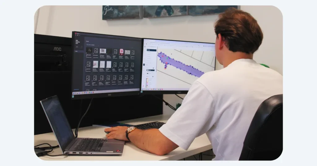
Import and export
Bring in a full AutoCAD drawing and export to DWG, DXF, LandXML, CSV, TXT or GeoJSON.
Projects
Set up layers and attributes once, use them in the field.
Real-time sync
Field data in the office the moment you save.
Share your results
Send a project to your client with a link or a QR code.
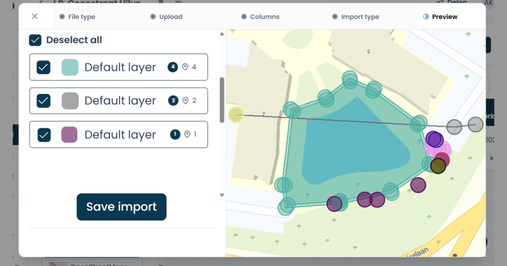
Layers and attributes
Set them up once in the office. In the field your crew picks them from a list, so every point lands in the right layer.
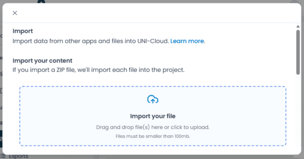
Drag and drop your files
Drop a drawing or a point file straight into the project. It is on the tablet at the next sync.
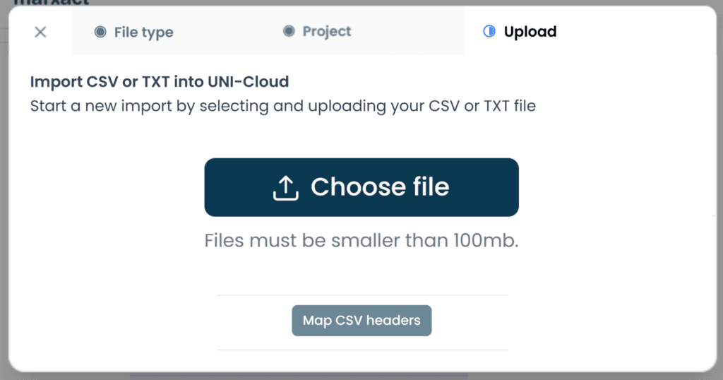
Import and export
Bring in a full AutoCAD drawing with automatic layer mapping, names and colours kept. Export to DWG, DXF, LandXML, CSV, TXT or GeoJSON.
Support that keeps you working
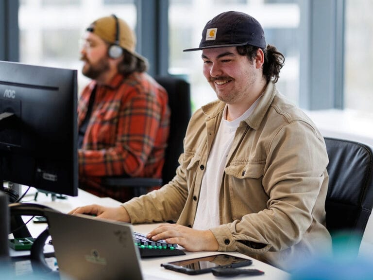
Our own support team in Hilversum answers the phone during office hours, on a local number in the Netherlands, Germany and the UK. Those three numbers are an extra, not a limit: we help customers worldwide, by phone, email and chat, in several languages. What customers tell us most is that we keep them moving. Someone picks up a kit from a colleague, has never used it before and calls to ask how to set it up: that is usually sorted on the phone in a few minutes. If talking it through is not enough, we can take over the receiver remotely and look at it with you. For the harder cases we stay on it until you can get on with your work.
- Email and chat support on every plan.
- Phone support and remote assistance from Professional.
- A replacement receiver if yours fails, on Ultimate.
What our customers say
“Measuring tapes are a thing of the past. With the UNI-GR2 we are now able to equip every worker, foreman or technician in the field with an easy to use receiver to survey.”

Heijmans
The Netherlands
“By using the UNI-GR2 and combining it with our GIS tools, we have been able to work more efficient. On fibre optics projects, we are now able to skip about 50 process steps!”

BAM Infra Telecom
The Netherlands
“The stake-out function saves us a lot of time, with quick loading of points and lines. It’s easy to use, which is a big plus. We use the UNI-GR2 for baseline measurements, construction work, and sewer projects, and we’re very satisfied with it.”
T. Van de Haterd
The Netherlands
Frequently asked questions
UNI-Collect is the field app for surveying and setting out. Measure and record points, lines and areas to the centimetre (cables and pipes, manholes, kerbs, trees and green), set out straight from a drawing so you know where things go, check heights and depths, and work out lengths, areas and volumes. It runs on iOS and Android.
No. It is built for people without a surveying background. If you can use a smartphone you can use it.
Yes. UNI-Collect works with the UNI-GR2, the older UNI-GR1, and any GNSS receiver that outputs NMEA-0183 over Bluetooth. You are not locked to our hardware.
Yes. UNI-Collect runs on your own iOS or Android device. For rough, non-precision work it can even use the device’s own location, though centimetre work needs a receiver.
You pick the coordinate reference system per project, with transformation grids on the device: RD and NAP in the Netherlands, OSGB36 in the UK, Lambert in Belgium, the German national grid and height system, and any other system you need.
NLCS and NLCS++ for cables and pipes, CROW 500 and the DSP exchange in the Netherlands, and open protocols like NMEA-0183. It supports trial trenches (proefsleuven) and digital construction supervision (digitale Baubegleitung). If a standard you need is missing, we are open to it and think along with you.
Yes. Your projects and layers sit on the device, so you keep measuring offline and everything syncs to UNI-Cloud once you have coverage again.
Import CSV, TXT, DXF, DWG, LandXML, GeoJSON, KML and ESRI Shapefile. Export DWG, DXF, LandXML, CSV, TXT and GeoJSON, and from Q3 2026 also PDF reports. You can share a project and its map through a view link or QR code, so a client opens the result without any software.
Yes, through the receiver. Use our UNI-RTK Premium network, or your own NTRIP service such as SAPOS or FLEPOS, which are free.
The UNI-Collect app comes with UNI-Cloud. The UNI-Cloud plans, Professional at € 750 and Ultimate at € 1.095 per user per year, unlock more projects and layers, the KLIC map and CAD export. See the UNI-Cloud plans for the details.
We develop the app in-house in Hilversum, the Netherlands, alongside the UNI-GR2 hardware. One company behind the whole chain.
Yes. We’re happy to show you the system first with a no-obligation demo on location: at your job site, at your company, or at our office. When we deliver, we walk through it together so you can start right away. On-site training is available if you want it, but it’s not a must: if you can use a smartphone, you can work with this. Think of it as extra certainty that you get everything out of it. And you can always call us.
Try UNI-Collect on your own project
We come to your site, pair a receiver and let your own crew take the first measurement.
Or call us: +31 (0)70 700 7917