
UNI-Cloud
Where all your field work comes together
The universal GIS cloud that connects the field to your office. Plan projects and layers once, see every measurement land the moment it is saved, and pull KLIC cable and pipe data straight into the same map.
Trusted by 1000+ companies
More than 10 million objects measured, in more than 40 countries.














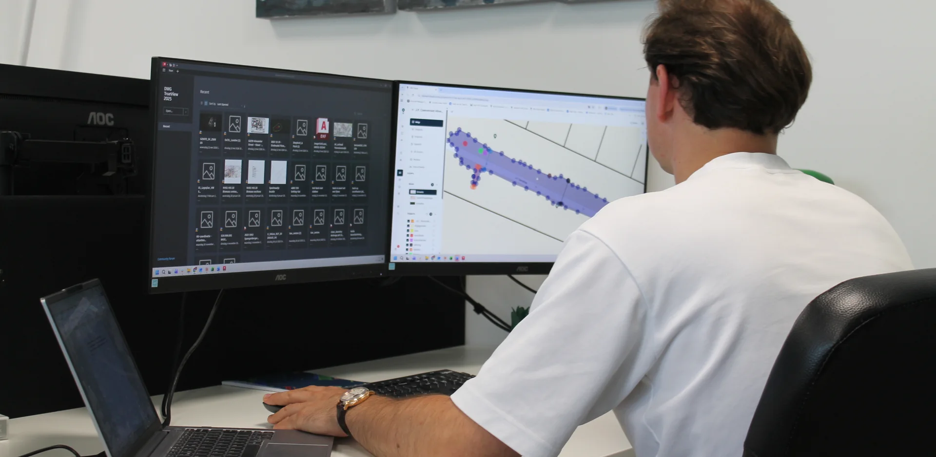
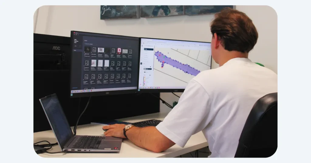
UNI-Cloud is the base for every marXact product. The moment you save in the field, your data is in the office, ready to plan, check, share and export.
One hub, field to office
Field data lands in the office the moment you save. No cables, no manual imports.
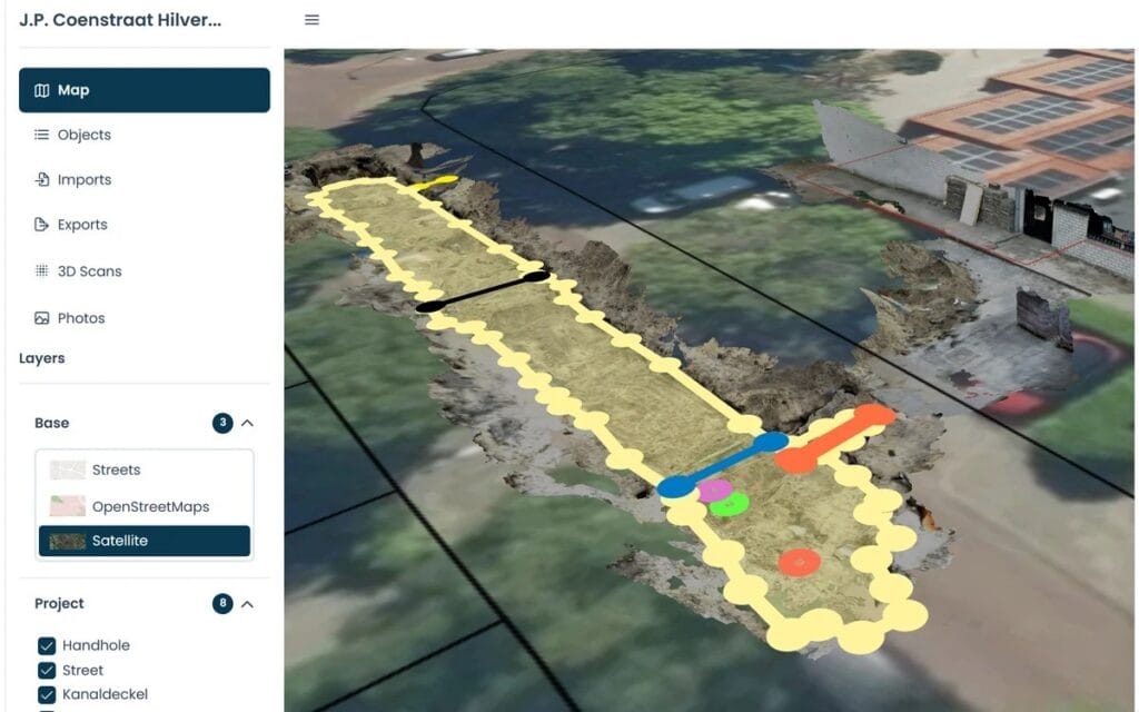
Plan once, use in the field
Set up layers, attributes and groups in the cloud and reuse them on every job.
Share the same day
Send results to a client with a link, or export to CSV, TXT, DXF, DWG, LandXML and KML. GeoJSON and ESRI Shapefile are on Ultimate.
What UNI-Cloud does
Everything your field data needs, in one place
Import in the formats you already use
CSV, TXT, DXF, DWG, LandXML and KML, plus GeoJSON and ESRI Shapefile on Ultimate, or a ZIP with a set of files.
Projects
Set up layers and attributes once, and prepared groups like NLCS on Ultimate, then use them everywhere.
Real-time sync
Field data appears in the office the moment you save, on every device.
Measure on the map
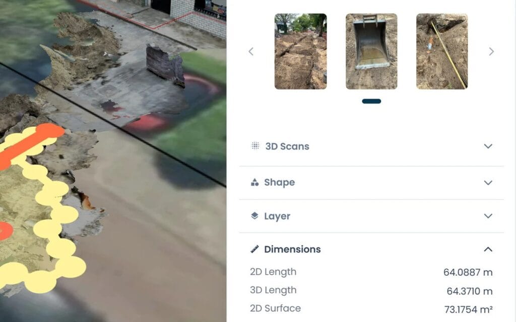
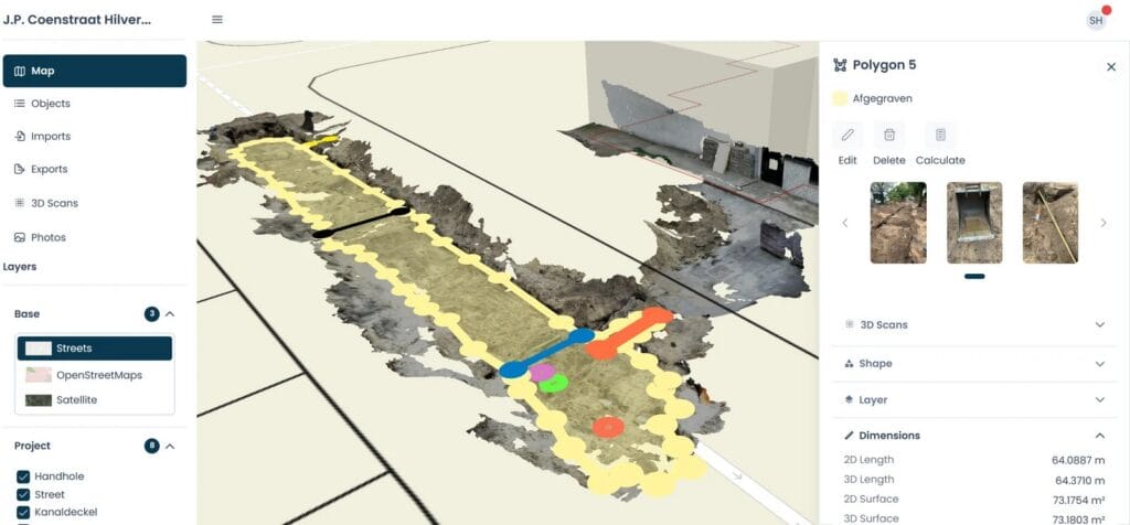
Length, area and volume on the objects you recorded in the field.
Share without an account
Send a public project link or a QR code. The person you send it to does not need an account.
API for partners
Integrate marXact into your own software with the UNI-Cloud API. Partners read and write projects, layers and objects programmatically.
See, measure and hand over your project in the browser
Layers decide what the field sees, and Ultimate adds layer groups. Set them once and reuse them on every job.
- Bring in what you already have: CSV, TXT, DXF, DWG, LandXML and KML, plus GeoJSON and ESRI Shapefile on Ultimate, or a whole ZIP
- Measure length and perimeter
- Measure area and calculate volume over a polygon
- Organise everything in layers and attributes, with layer groups on Ultimate
- Photos on points and polyshapes, 3D LiDAR scans in a viewer
- Work in the coordinate reference system of your project
Hand it over in the format the office uses
- DWG and DXF straight into AutoCAD
- LandXML, KML, CSV and TXT, plus GeoJSON and ESRI Shapefile on Ultimate
- In 2D or 3D, per layer or the whole project
- Public share link with a QR code, no account needed
Get your existing drawing in, step by step
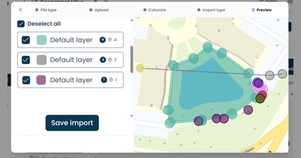
Bring in what you already have. Import CSV, TXT, DXF, DWG, LandXML and KML, plus GeoJSON and ESRI Shapefile on Ultimate, or a whole ZIP at once. Layers with the same name map themselves, and the name and colour come across from the CAD layer. With an AutoCAD drawing the unit is detected for you and the object names stay intact. Large drawings come in as a background layer. Out of time? Save the import as a draft and pick it up later.
A drawing arrives as layers with points, lines and areas, not as a CAD drawing one to one.
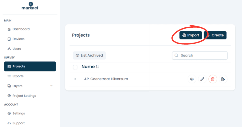
1. Start an import from the project overview, or create the project in the same flow.
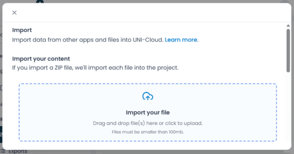
2. Drop the file in, or pick it from your computer. A ZIP takes a whole batch at once.
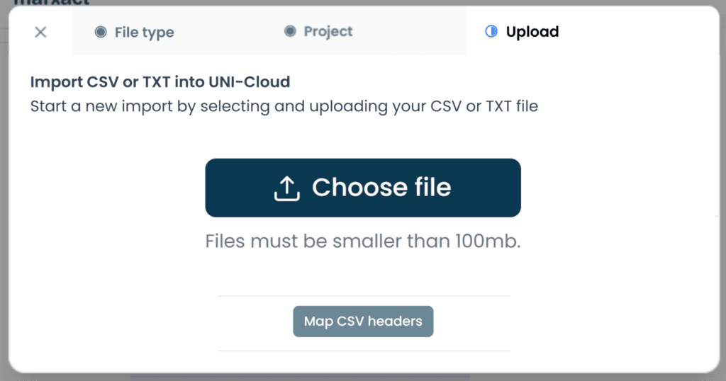
3. CSV and TXT work with or without a header row, and carry points, lines and polygons.
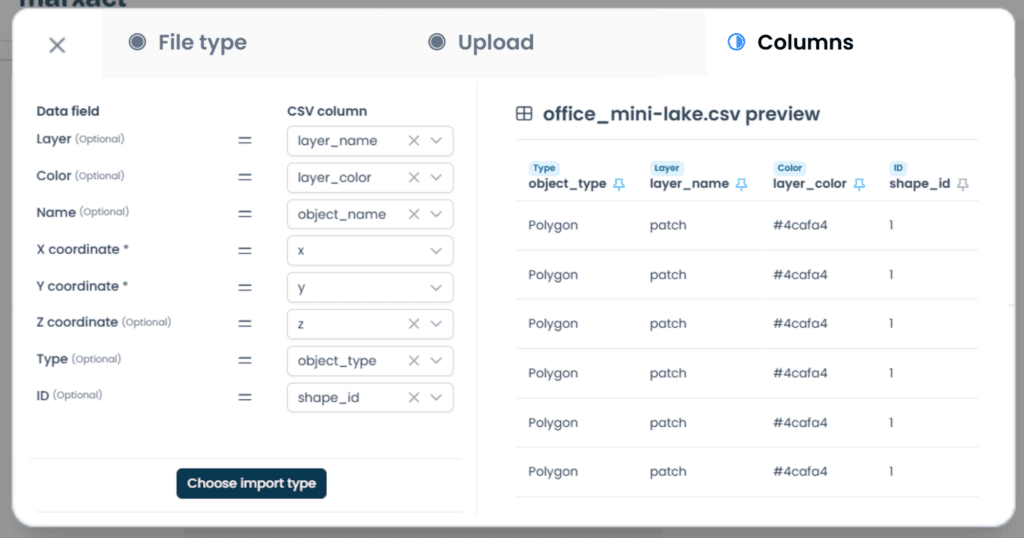
4. Assign the columns while you look at the real contents of your own file.
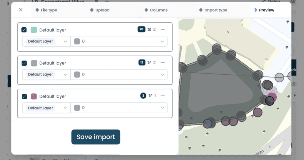
5. Layers with the same name link automatically. Switch one layer off and import the rest.
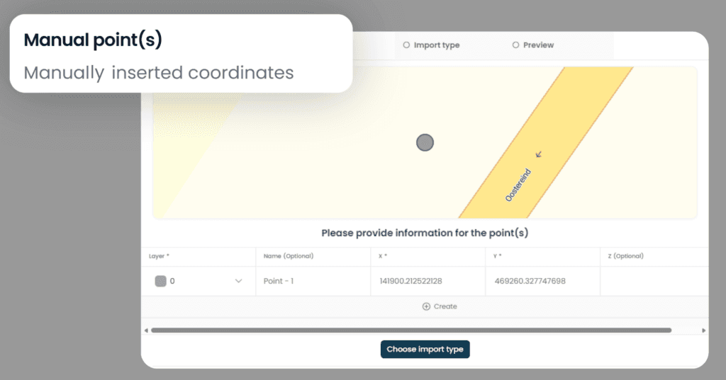
6. No file? Type the coordinates by hand and watch each point land on the map.
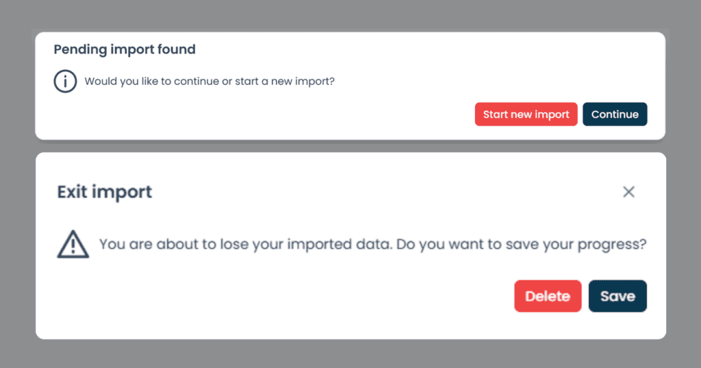
7. Out of time? Save the import as a draft and pick it up later, also on another computer.
What it does
Everything the platform does, grouped
Import, prepare, measure, share and export, all in the browser. What is not there yet is marked as such.
Import and export
- In: CSV, TXT, DXF, DWG, LandXML and KML, plus GeoJSON and ESRI Shapefile on Ultimate, or a ZIP with a set of files.
- A full AutoCAD drawing with automatic layer mapping, names and colours kept.
- The Import Assistant shows a preview at every step, and an unfinished import saves as a draft.
- Out: DXF, DWG, LandXML, KML, CSV and TXT, plus GeoJSON and ESRI Shapefile on Ultimate, in 2D or 3D, per layer or the whole project.
Background and reference data
- Cadastral lines for the Netherlands, Belgium and Germany.
- Large drawings as a fast background layer, in the field and in the cabin.
- 1 WMS/WFS service per project on Professional, unlimited on Ultimate.
- A coordinate system per country, set when you create the project, and the file's own system read on import.
Measure
- Length on lines and area on shapes, in 2D and in 3D.
- Volume over a surface in the 3D view.
- Enter a point by hand.
- An object list with zoom to the object, and archived points when you need them.
Prepare the set-out
- Your drawing and your points loaded into the project before anyone drives out.
- Layers decide what the field sees, and layer groups on Ultimate.
- Attributes and prepared groups like NLCS on Ultimate, set once and reused on every job.
- The project is on the tablet as soon as it syncs, with the layers you prepared.
Photos and 3D
- Photos on a point or a shape, with EXIF, syncing on their own.
- Scans and photos on the map in UNI-Cloud, in a 3D viewer.
- A photo gallery with continuous scrolling, bulk actions and zoom to the object.
- Photos and scans land on the map on the centimetre, on the position of the UNI receiver, not on the tablet's own GPS.
Share and work together
- A public project link or a QR code, no account needed on the other side. 1 at a time on Professional, unlimited on Ultimate.
- The shared view also shows your 3D scans and the points you set out.
- Users, groups and rights.
- Real-time sync.
- An API and WebSockets for your own integration.
Coming soon: basic CAD drawing in UNI-Cloud. PDF reports are in the works.
KLIC (Netherlands)
KLIC notifications in the field and on the map
Your KLIC data sits in the same project as your measurements, in the field and in the office.
- KLIC viewer as a layer over your project in UNI-Cloud.
- Open and download KLIC documents from UNI-Cloud.
- Use imported GeoJSON as a KLIC layer.
- Use KLIC codes in UNI-Collect on the tablet.
- Also visible in UNI-Machine in the cabin.
KLIC layer available on every UNI-Cloud plan. Requesting and paying for KLIC in UNI-Cloud launches in October 2026.
One platform for everyone who works on site. From a single GNSS receiver to a full machine setup, everyone works from the same project.
Plans
Pick the UNI-Cloud plan that fits
Every plan works with the UNI-Collect app. Prices per user, per year, excl. VAT.
Free
per user / per year
- 3 projects, 3 layers
- 50 objects per project
- Enter a point by hand
- CSV import & export
- Email & chat support
Starter
per user / per year
- 10 projects, 10 layers
- External Bluetooth GNSS
- Draw points, measure length
- CSV & GeoJSON export
- Email & chat support
Most chosen
Professional
per user / per year
- 50 projects & layers, unlimited objects
- 100 MB storage per seat
- Draw points, lines & polygons
- Measure length, area & volume
- 1 WMS/WFS service, 1 share and 1 public link
- DXF, DWG, LandXML, KML, CSV & TXT export
- Bluetooth GNSS & UNI-GRx with tilt
- KLIC map layer (NL), request & pay from October 2026
- Phone & remote support
Ultimate
per user / per year
- Everything in Professional
- Unlimited projects & layers
- Layer groups with NLCS & NLCS++
- Draw surfaces & point-to-point measuring
- GeoJSON & ESRI Shapefile export, filter by date
- Unlimited shares & public links
- 10 GB storage per seat, +10 GB for € 99 per year
- Replacement device included

Support
Support that keeps you working
Our own support team in Hilversum answers the phone during office hours, on a local number in the Netherlands, Germany and the UK. Those three numbers are an extra, not a limit: we help customers worldwide, by phone, email and chat, in several languages. What customers tell us most is that we keep them moving. Someone picks up a kit from a colleague, has never used it before and calls to ask how to set it up: that is usually sorted on the phone in a few minutes. If talking it through is not enough, we can take over the receiver remotely and look at it with you. For the harder cases we stay on it until you can get on with your work.
- Email and chat support on every plan.
- Phone support and remote assistance from Professional.
- A replacement receiver if yours fails, on Ultimate.
What our customers say
“Measuring tapes are a thing of the past. With the UNI-GR2 we are now able to equip every worker, foreman or technician in the field with an easy to use receiver to survey.”

Heijmans
The Netherlands
“By using the UNI-GR2 and combining it with our GIS tools, we have been able to work more efficient. On fibre optics projects, we are now able to skip about 50 process steps!”

BAM Infra Telecom
The Netherlands
“The stake-out function saves us a lot of time, with quick loading of points and lines. It’s easy to use, which is a big plus. We use the UNI-GR2 for baseline measurements, construction work, and sewer projects, and we’re very satisfied with it.”

T. Van de Haterd
The Netherlands
One hub, every package
UNI-Cloud powers all marXact solutions
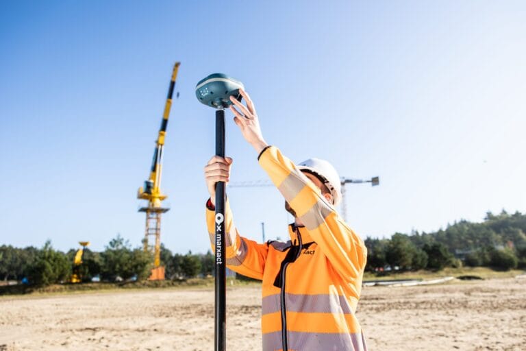
UNI-Collect Survey Package
GNSS surveying and stake-out for non-surveyors.
complete survey package, excl. VAT
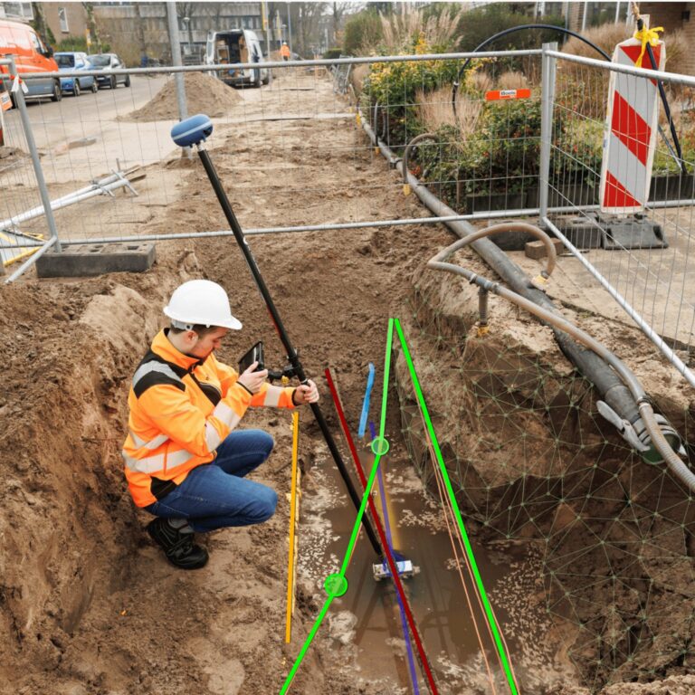
UNI-Collect 3D Package
Add 3D LiDAR reality capture with the iPad Pro.
complete 3D package, excl. VAT

UNI-Machine
3D GPS machine control for excavators.
from complete excavator package, excl. VAT
Frequently asked questions
The online platform where all your field work comes together. Every point, line and project syncs from UNI-Collect, so you plan the work, manage the data, and share it with the office and the client.
Per user, per year, excl. VAT. Professional is € 750 and covers 50 projects and layers, unlimited objects, 100 MB of storage per seat, drawing and measuring in the cloud, and the KLIC map layer. Ultimate is € 1.095 and adds unlimited projects and layers, layer groups with NLCS and NLCS++, unlimited shares and public links, 10 GB of storage per seat, and a replacement device if yours fails.
In a private cloud at two Dutch providers, TransIP and Cyso Cloud, with data centres in the Netherlands, both ISO 27001 and NEN 7510 certified. Your project data is stored in the Netherlands and falls under the GDPR. We never sell your data.
We never sell your data. To run the service, we work with a limited number of processors, such as our hosting providers TransIP and Cyso Cloud and the tools our support team uses.
UNI-Cloud is mainly for location and object data. From the Professional plan you can also store photos, and a photo can contain personal data such as a person or a number plate, so a data processing agreement is appropriate. We are happy to work with you on this and can review the agreement that fits your own standards.
Yes. On both plans you can share a public view link or a QR code of a project and its map, so a client opens the result in a browser without any software or login. Professional allows 1 public link at a time, Ultimate unlimited.
Yes, on every UNI-Cloud plan in the Netherlands. The KLIC cable and pipe map loads as a layer over your project, in the field and in the office. Requesting and paying for KLIC in UNI-Cloud launches in October 2026.
Yes, each user gets their own login. Plans are per user, per year.
Import CSV, TXT, DXF, DWG, LandXML, KML, and on Ultimate also GeoJSON and ESRI Shapefile. Export DXF, DWG, LandXML, KML, CSV and TXT on both plans, and GeoJSON, ESRI Shapefile and export filtered by date on Ultimate.
Layer groups with prepared NLCS layer groups and the NLCS++ workflow are part of the Ultimate plan. If a standard you need is missing, we think along with you.
In-house in Hilversum, the Netherlands, alongside our hardware. European build quality, one company behind the whole chain.
See it on your own projects
See UNI-Cloud on your own projects
Book a demo and we walk through the field, your office and the cloud with your own data.
Or call us: +31 (0)70 7007917