01/02/2024 / 4 min read
This article has been published (in Dutch) by GreenPro in Febuary 2024.
Digital surveying is being embraced by more and more garden and landscape designers
Digitally measuring and laying out fencing, vegetation, paving or a custom-made pond is being embraced by more and more garden and landscape designers. It is simple, accurate, but above all time and cost saving. The UNI-GR2 is a digital receiver that uses satellite signals to determine exact positions. You can use this to determine a point, line or polygon with accuracy down to the centimeter. Technology that was previously quite expensive, but has now become accessible thanks to the Dutch company marXact.
“Anyone who can use a smartphone can work with this system,” says Nick Raimond, marketing manager at marXact. The company was founded in 2017 with the idea of making surveying via the Global Navigation Satellite System (GNSS) available to everyone. In other words: easy and innovative software and hardware, for an attractive price. The result is a real Made in Holland product, as the entire measuring system is developed and produced in-house.
Growing interest
“The infrastructure sector makes up a large part of our target group, but gardeners, garden designers and landscape architects are also showing increasing interest. We are always prepared to give a no-obligation demonstration on location and we see that this allows people to experience how easily and efficiently the system works. Many environments are not suitable for measuring with a tape measure. In addition, this manual method is a time-consuming and error-prone activity. Or expensive, if you outsource it to a professional surveyor. Because this technology has now become much more price-friendly, it offers a solution to a large group of green professionals.”
User friendly
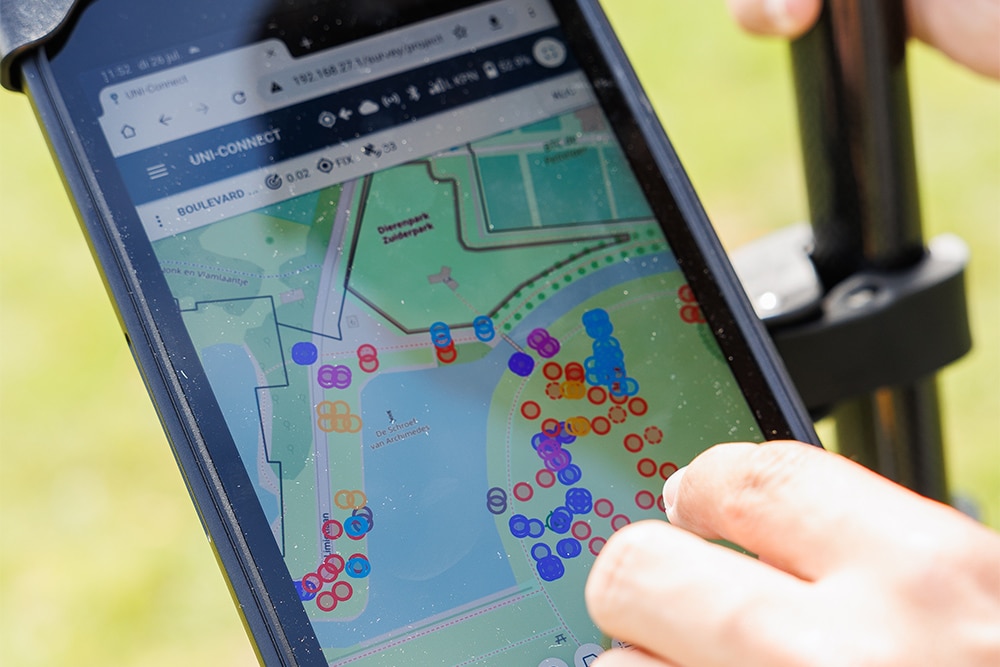
“With the system you can easily save measuring points, lines or polygons. Or you send them automatically to the office. You always have the data at hand. You can also easily import and export them in the desired format. From a complete 3D CAD drawing to all details in a CSV export.” Raimond continues: “But the system not only ensures that you can enter points very quickly yourself. You can also find the coordinates of the land registry or a client in no time.”

Efficient and multifunctional
“We hear from users that the system simplifies the preparation phase and makes it more accurate. After all, you know in advance exactly how many square meters you have at your disposal. Where the property line runs, where there is a tree that needs to be preserved or how many square meters of terrace and paths you want to build. This means you know exactly how many materials you need, which makes drawing up a quote and planning easier. The design executor can then use the system to quickly see at which point a shrub is planned, which shrub should remain, up to which point the border should be constructed, and so on. And suppose the client wants a change at the last minute, then you can use this system to check whether this is possible and what the best solution would be.”
Further development
The system is regularly provided with new functions and options. “We listen a lot to feedback from the field. For example, the current receiver, the UNI-GR2, has recently been improved. It works faster and has better reception near tall buildings or a tree-lined situation. Gardeners and garden designers in particular are of course very happy with the latter.”

UNI-Complete package
With UNI-Complete from marXact you receive everything you need to get started immediately with digital measuring and plotting points, lines and surfaces. The package contains the aforementioned UNI-GR2 receiver, a waterproof tablet, tablet holder, measuring pole and the necessary software. Included are the Cloud subscription and GPS subscription for the first year.