This article has been published by Surveying Group in January 2021. Surveying Group offers digital media services for surveying professionals.
Your introduction to digital surveying
We have published some articles on digital surveying here on Surveying Group recently, all created to introduce you to this new way of working. We have begun with a story on how everyone can (digital) survey easily and why you should too. Digitalization is happening around us, the use of digital technologies to change a business model and create new opportunities, allows for growth and added value.
We followed up on that article with one highlighting working in the cloud. That work method allows everyone to save surveyed data in an online and personal data base, the so-called ‘cloud’. This information can be accessed from any preferred location, such as office and home – completely COVID-19 proof. By having access from multiple locations, you can actually review surveyed data while your colleagues are still out in the field!
The third article we’ve posted on this subject, focuses on the difference between old school and new school surveying. Traditionally, distances and (individual) points were the help of a design network in a software program, followed by staking out and exporting points, before the data export and revision. That process could take up to one week, which is both time and money consuming. Digital survey speeds up your process, with preparing, working in the field, exporting, and revision possible on the same day

Getting started
After re-introducing you to our earlier published articles, it is time to dive into actually getting started with digital surveying. The first question you should ask yourself is: how big is your actual need? Do you survey on a weekly or even daily basis? Is generating centimetre accurate data a recurring part of your work week? If so, you should definitely keep on reading. Do you have only a handful of jobs per year that require surveying skills? You might consider relying on land surveyors, since your need is very small and a hiring fee or new investment might be the same. Just a suggestion and something to think about. You can also think about the services you provide. Adding digital surveying to products and services you already offer, makes you more all-round. More of a ‘go-to’ organization for (potential) customers who are in need of some type of help, but would like to keep the number of associated companies as small as possible. Meaning you could be the only one associated.
So, we’ve established you have a need for digital survey. The next step is researching all available options. In order to find the possibilities that work best for you, ask yourself a few questions: do you require centimetre or millimetre accurate data, or is the accuracy of 1-3 centimetres enough? Are you surrounded by high buildings, trees, and other objects while surveying? They can block some satellite signals, which might adjust the achieved centimetre accuracy, but that’s not a problem when a few centimetres of accuracy is enough. These kinds of questions have lots to do with how you start digital surveying. After all, these are the basics to determine what kind of equipment suits your need best.
Digital surveying made easy
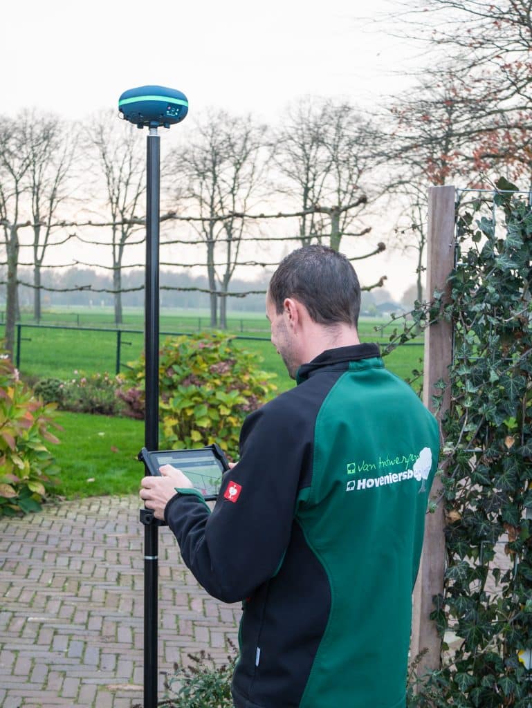
One of the ways to make digital surveying as easy as possible, is using the equipment brought to the market by marXact. This Dutch company designs, produces, and sells its own GNSS surveying equipment, meaning you can be centimetre accurate with every job you perform. Their goal is to make digital surveying easy and affordable for fieldworker who knows how to use a smartphone. Their product range allows for non-surveyors to digital survey up to 90% of all jobs, with the remaining 10% left to be measured by land surveyors. Performing almost every job yourself, means an enormous improvement in productivity and cost-effectiveness. You are in charge of planning and timing, because you do not have to depend on the availability of a land surveyor. And since you perform most jobs, you’ll keep (most of) your money in your pocket, instead of spending it on hiring rates for outside professionals.
What makes digital surveying with marXact even more easy, is how versatile its products are. All product names start with ‘UNI’, which stands for ‘universal’. This means that they can be used in combination with products from other brands. For example, you can use marXact hardware, the UNI-GR1 GNSS receiver, and combine that with the surveying software you already use. You can use both hard- and software from marXact if you like, but you don’t have to. This ensures you benefit from the full surveying experience and design that to be exactly what you want and need.
Creating the ultimate surveying experience
As we’ve mentioned before, marXact offers both hard- and software. You create the ultimate surveying experience using the following items:
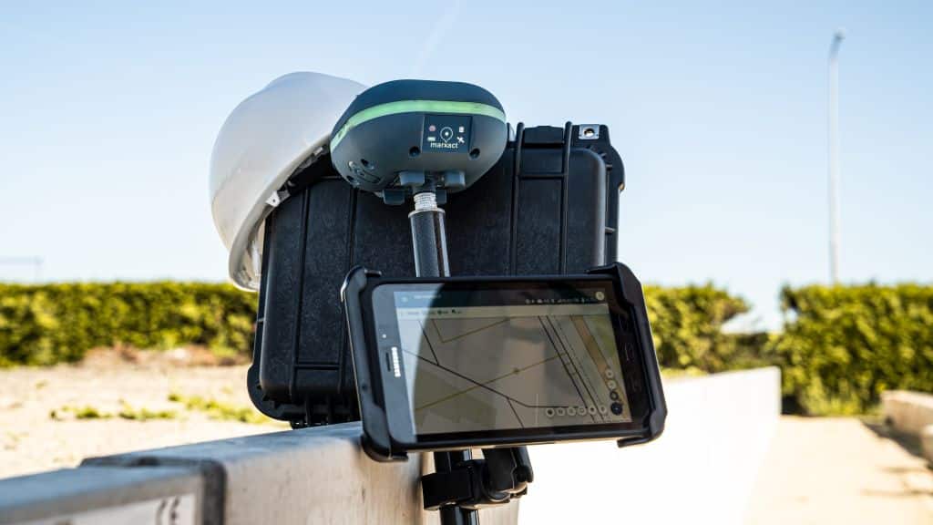
- UNI-GR2, the GNSS receiver that receives GPS, Glonass, BeiDou, Galileo, QZNSS, and SBAS to get positions easily and accurately;
- UNI-Collect, the most easy surveying software on the market. UNI-Collect works on any device with a browser and WiFi, using it is as easy as playing a game;
- UNI-Cloud, to get your data from and to the field (or office) in no time. Connects to the UNI-Cloud API and gives the opportunity to call for help with remote and phone support from digital surveying experts;
- UNI-RTK Premium, with hundreds of base stations all over the world, this network gives you centimetre accurate correction data wherever you are.
- Pole, tablet, and mount. Where would we be without the accessories to survey with the UNI-GR1? A weatherproof Android tablet, 2-meter carbon fibre survey pole, and mount to hold the tablet, make your surveying job much easier.