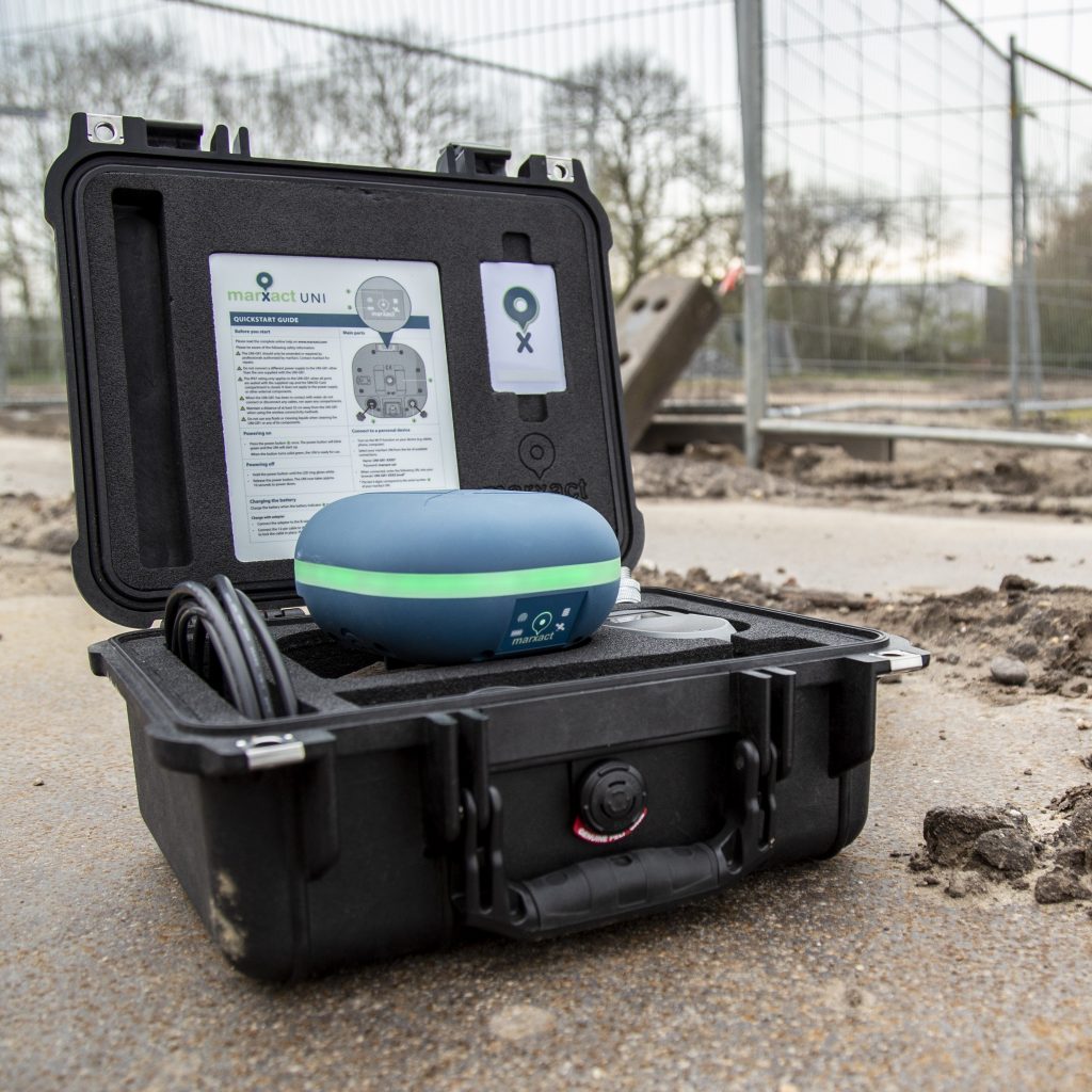
GOconnectIT and marXact: an interesting infra combination

This article has been published by OTAR Magazine in April 2022. The need to map out cables and pipelines quickly and easily is rapidly advancing in the infrastructure sector. Indicate centimetre accurately where they are located already or where they need to be dug without causing excavation damage. GOconnectIT and marXact offer an interesting combination in which […]
Greenpoint & marXact

Greenpoint is an online platform for managing the outdoor space. Companies, municipalities, and contractors can get data about objects in the outdoor area with their software. Greenpoint ables you to record the information and access it very easy in map images that provide visual recognition. With the BOR-solution you can collect and manage all your […]
TCPGPS by Aplitop & marXact
Aplitop is a company that is specialized in the design and programming of technical applications for Civil Engineering and Surveying. They have developed a broad variety of solutions for field surveying and working with stake-outs. They’ve also developed CAD-based software for civil projects and special applications for point-clouds, tunnels, and photogrammetry. A fundamental aspect of their […]
MyCumulus & marXact
Mycumulus is a cloud-based service that has been released by ADW software. MyCumulus is a combination of an app, a website, and utilities. Users can create their projects, create forms, collect or update data on android devices. They can view this data on the MyCumulus website. The application allows users to measure positions and those […]
Heijmans goes UNI!

Measuring while the ground is still open and having anyone in your team measure the work. It’s what the infra and construction world is screaming for and with the UNI-GR1; Heijmans is able to do it! And who better to tell you how they do it, than the lead surveyor himself? Check out the video; […]
GeolinQ & UNI-Cloud

GeolinQ is a no-code, web-based, software solution to collect, link and publish spatial data in an efficient and flexible way. Almost any application varying from managing data, doing inspections, data warehousing, reporting, map portals, data delivery validated to formal standards etc. can be configured in GeolinQ without any programming. Data from various sources are linked by […]
UNI-Cloud API

Did you know that with the UNI-Cloud API, you can completely integrate your UNI-GR1 GNSS receiver in your own software? Now you know! Next step is knowing what that means for your company… And that is virtually anything! Cause when having the centimetre accurate position of the UNI-GR1 integrated to your own systems, you are […]
QGis & marXact

Create, edit, visualise, analyse and publish geospatial information with QGIS! QGIS is a user friendly Open Source Geographic Information System (GIS) licensed under the GNU General Public License. QGIS is an official project of the Open Source Geospatial Foundation (OSGeo). It runs on Linux, Unix, Mac OSX, Windows and Android and supports numerous vector, raster, […]
ESRI ArcGIS Data Collector & marXact
At marXact, we are excited to announce the seamless integration of our UNI-GR2 with Collector for ArcGIS by ESRI, offering our users a reliable and flexible solution for field data collection! Collector for ArcGIS by ESRI is a powerful mobile data collection application designed to streamline the process of capturing accurate spatial data in the field. […]
Carlson SurvPC & marXact

Carlson Software develops software solutions that helps the land development professional from concept to completion – the full cycle of a project. As an independent company founded in 1983, Carlson Software is well known for its comprehensive civil engineering, land surveying, machine control, positioning, and mining software solutions. Its dedication to customer service is renowned in […]