GOconnectIT y marXact: una interesante combinación infra

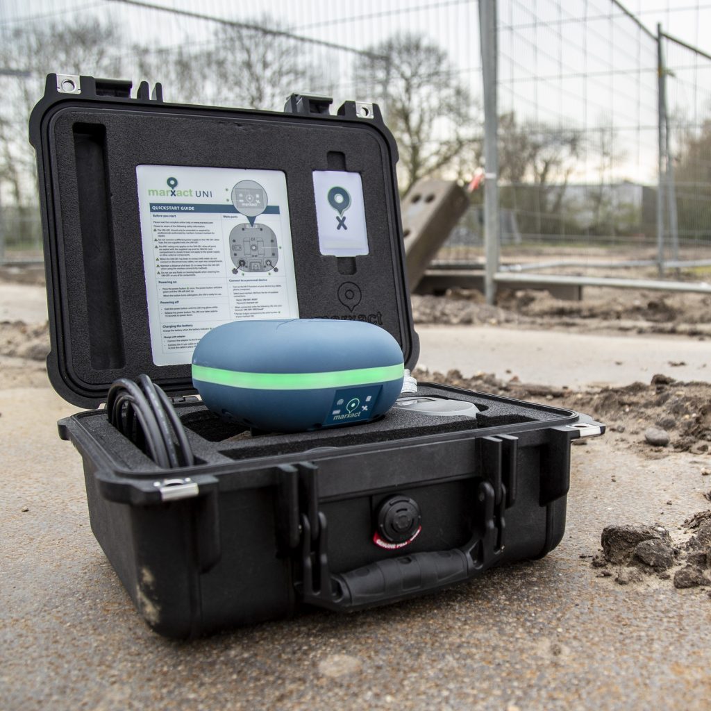
Este artículo ha sido publicado por la revista OTAR en abril de 2022. La necesidad de trazar cables y tuberías de forma rápida y sencilla avanza rápidamente en el sector de las infraestructuras. Indicar con precisión centimétrica dónde se encuentran ya o dónde hay que excavar sin causar daños en la excavación. GOconnectIT y marXact ofrecen una interesante combinación en la que [...]
Greenpoint y marXact

Greenpoint es una plataforma en línea para gestionar el espacio exterior. Empresas, ayuntamientos y contratistas pueden obtener datos sobre los objetos del espacio exterior con su software. Greenpoint permite registrar la información y acceder a ella muy fácilmente en imágenes de mapas que proporcionan reconocimiento visual. Con la solución BOR podrá recopilar y gestionar todos sus [...]
TCPGPS por Aplitop y marXact
Aplitop es una empresa especializada en el diseño y programación de aplicaciones técnicas para Ingeniería Civil y Topografía. Han desarrollado una amplia variedad de soluciones para la topografía de campo y el trabajo con replanteos. También han desarrollado software basado en CAD para proyectos civiles y aplicaciones especiales para nubes de puntos, túneles y fotogrametría. Un aspecto fundamental de su [...]
My Cumulus y marXact
Mycumulus es un servicio basado en la nube que ha sido lanzado por ADW software. MyCumulus es una combinación de una aplicación, un sitio web y utilidades. Los usuarios pueden crear sus proyectos, crear formularios, recopilar o actualizar datos en dispositivos android. Pueden ver estos datos en el sitio web de MyCumulus. La aplicación permite a los usuarios medir posiciones y [...]
¡Heijmans elige el UNI!

Medir cuando el terreno aún está abierto y hacer que cualquier persona de su equipo mida la obra. Es lo que pide a gritos el mundo de la infraestructura y la construcción y, con el UNI-GR1, Heijmans puede hacerlo. ¿Y quién mejor para contarle cómo lo hacen que el propio topógrafo jefe? Vea el vídeo; [...]
GeolinQ y UNI-Cloud

GeolinQ es una solución de software sin código, basada en web, para recopilar, vincular y publicar datos espaciales de forma eficiente y flexible. Casi cualquier aplicación, desde la gestión de datos, la realización de inspecciones, el almacenamiento de datos, la elaboración de informes, los portales de mapas, la entrega de datos validados según normas formales, etc., puede configurarse en GeolinQ sin necesidad de programación. Los datos de diversas fuentes se vinculan [...]
API de UNI-Cloud

¿Sabía que con la API UNI-Cloud puede integrar completamente su receptor GNSS UNI-GR1 en su propio software? ¡Ahora ya lo sabe! El siguiente paso es saber qué significa eso para su empresa... ¡Y es prácticamente cualquier cosa! Porque al tener la posición de precisión centimétrica del UNI-GR1 integrada en sus propios sistemas, usted [...]
QGis y marXact

Cree, edite, visualice, analice y publique información geoespacial con QGIS. QGIS es un Sistema de Información Geográfica (SIG) de código abierto y fácil de usar, licenciado bajo la Licencia Pública General GNU. QGIS es un proyecto oficial de la Open Source Geospatial Foundation (OSGeo). Se ejecuta en Linux, Unix, Mac OSX, Windows y Android y es compatible con numerosos sistemas vectoriales, [...]
ESRI ArcGIS Colector de datos y marXact
En marXact, nos complace anunciar la perfecta integración de nuestro UNI-GR2 con Collector for ArcGIS de ESRI, que ofrece a nuestros usuarios una solución fiable y flexible para la recopilación de datos sobre el terreno. Collector for ArcGIS de ESRI es una potente aplicación móvil de recopilación de datos diseñada para agilizar el proceso de captura de datos espaciales precisos sobre el terreno. [...]
Carlson SurvPC y marXact

Carlson Software desarrolla soluciones de software que ayudan al profesional de la urbanización desde el concepto hasta la finalización, es decir, el ciclo completo de un proyecto. Como empresa independiente fundada en 1983, Carlson Software es conocida por sus completas soluciones de software para ingeniería civil, topografía, control de maquinaria, posicionamiento y minería. Su dedicación al servicio al cliente es reconocida en [...]