UNI-GR2 RTK GNSS receiver
The UNI-GR2 is our most universal RTK GNSS receiver. Six constellations, many frequencies and open interfaces give you a centimetre-accurate fix in almost any environment, and let you connect it to the tools you already use.
Rugged, waterproof and accurate. Connect any phone or tablet to the UNI’s Wi-Fi hotspot and run UNI-Collect, or the software of your choice. The UNI-GR2 also connects over Bluetooth, serial, USB, 4G and LoRa, so it fits the way you already work.
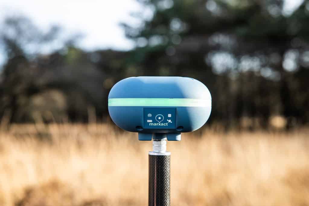
GPS, GLONASS, Galileo, BeiDou, QZSS and NavIC on many frequencies, with SBAS support for a reliable fix. 1408 channels in one receiver.
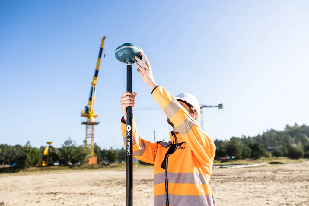
Run it as a rover on UNI-RTK Premium, or set it up as a base to feed corrections to another UNI. Both work out of the box.
Connect any phone or tablet to the UNI’s Wi-Fi hotspot and run UNI-Collect. Drop in a SIM and the receiver uses 4G in the field.
Run UNI-Collect on your own phone or tablet, or pair the receiver with the software you already use. Open interfaces and a standard NMEA output keep the choice yours.
IP67 waterproof and rated from -20 to +55°C. It keeps measuring in rain, dust and cold.
A built-in 10,400 mAh battery runs 10+ hours, up to a full working day. At 800 grams it stays light on the pole.
Trusted by 1000+ companies
More than 10 million objects measured, in more than 40 countries.


| Channels | 1408 |
| GPS | L1C/A, L1C, L2P(Y), L2C, L5 |
| GLONASS | G1, G2, G3 |
| Galileo | E1, E5a, E5b, E6 |
| BeiDou | B1, B2, B3 |
| QZSS | L1C/A, L1C, L2C, L5 |
| NavIC | L5 |
| SBAS | WAAS / EGNOS / GAGAN / MSAS |
| Standalone horizontal | 1.5 m |
| Standalone vertical | 2.5 m |
| DGPS horizontal | 400 mm |
| DGPS vertical | 800 mm |
| Static horizontal | 3 mm + 1 ppm |
| Static vertical | 6 mm + 1 ppm |
| RTK horizontal | 8 mm + 1 ppm |
| RTK vertical | 15 mm + 1 ppm |
| 12-pin connector | Charging, RS232, CAN, Host USB, PPS, Event |
| USB-C | USB Power Delivery, charging, data transfer |
| 4G mobile data | LTE, EDGE, GPRS, GSM, HSDPA+ UMTS |
| Wi-Fi | 802.11 a/b/g/n/ac |
| Bluetooth | 4.2 |
| NFC | Yes |
| Radio | LoRa 868 / 915 MHz |
| Level and tilt | 9DOF level LED ring and tilt compensation to 45°. Tilt accuracy 10 mm + 0.7 mm per degree. |
| Internal battery | 10,400 mAh |
| Battery life | 10+ hours (up to 12 h) |
| Weight | 800 g |
| Water & dust proof | IP67 |
| Operating temperature | -20 to +55 °C |
| Position output | NMEA-0183 |
Buy the receiver on its own, or as part of a complete set. The UNI-GR2 sits at the heart of all three, and works with UNI-Cloud and UNI-RTK Premium either way.
Digital surveying
complete survey package, excl. VAT
The UNI-GR2 with tablet, mount and pole, plus a year of UNI-Cloud, support and UNI-RTK Premium. Everything you need to start surveying.
3D scanning
complete 3D package, excl. VAT
The UNI-GR2 with an iPad Pro and LiDAR, so you capture point clouds and 3D detail alongside your normal survey work.

Machine control
from complete excavator package, excl. VAT
Two UNI-GR2 receivers, machine sensors and a control box, so the operator sees exactly where to dig without waiting for a surveyor.
Survey, set out, import, export and share, with the UNI-GR2 in UNI-Collect and UNI-Cloud. What is not there yet is marked as such.
Coming soon: basic CAD drawing in UNI-Cloud. PDF reports are in the works.
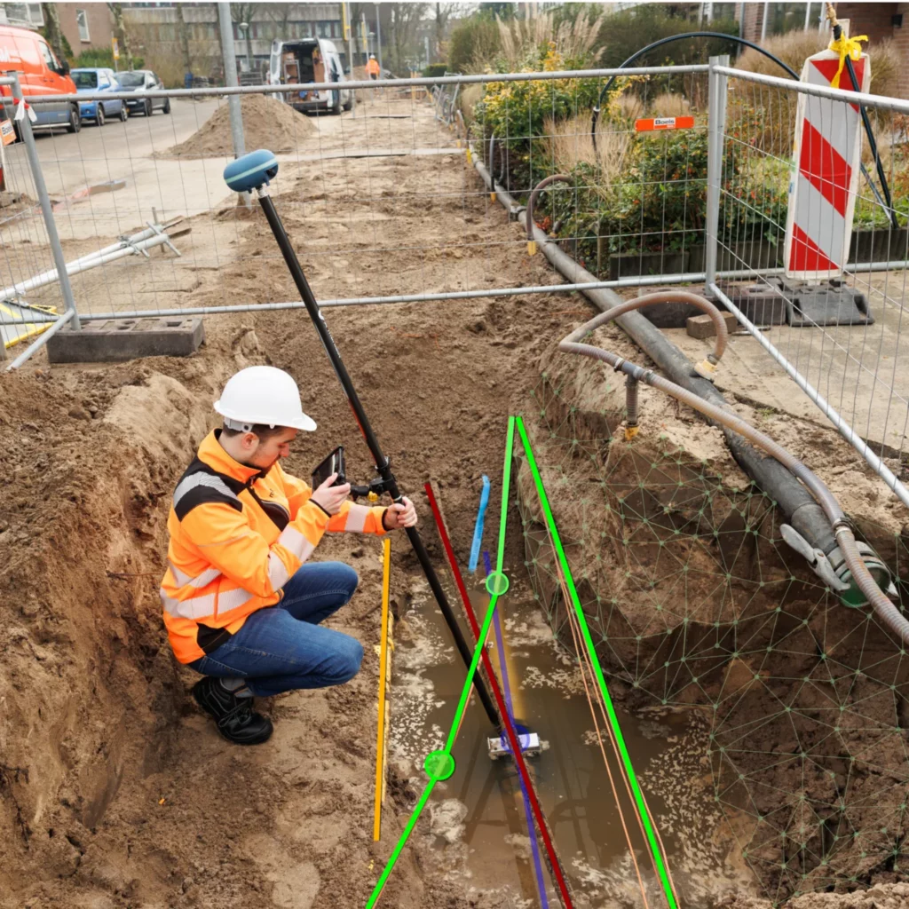
Your KLIC data sits in the same project as your measurements, in the field and in the office.
Available from UNI-Cloud Professional.
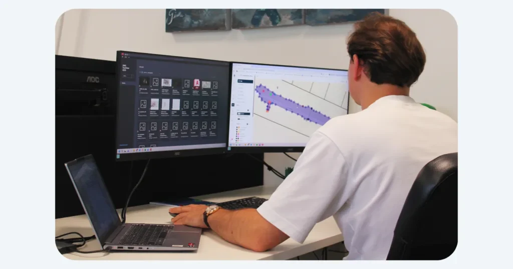
Every point, line and project syncs to UNI-Cloud. Plan the work, share with the office and clients, and keep the field and the desk on the same page.
Everyone who works in the project gets their own login.
UNI-Cloud is included in the UNI-Collect Survey Package for the first year.
Draw straight in the cloud and send a finished PDF report to your client.
Bring in a full AutoCAD drawing and export to DWG, DXF, LandXML, CSV, TXT or GeoJSON.
Set up layers and attributes once, use them in the field.
Field data in the office the moment you save.
Send a project to your client with a link or a QR code.
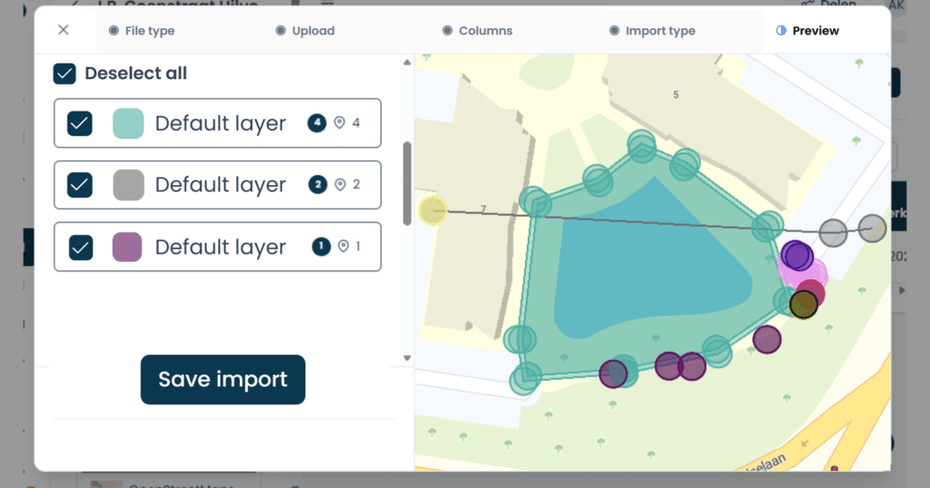
Layers and attributes
Set them up once in the office. In the field your crew picks them from a list, so every point lands in the right layer.
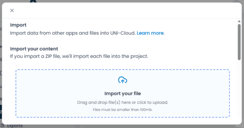
Drag and drop your files
Drop a drawing or a point file straight into the project. It is on the tablet at the next sync.
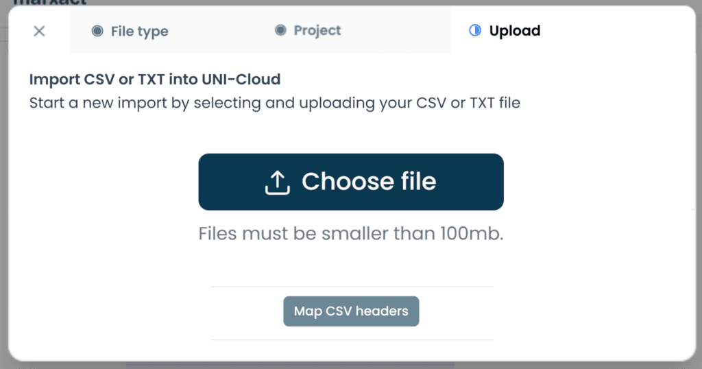
Import and export
Bring in a CSV of coordinates and set out from it. Export your results to AutoCAD, CSV or LandXML.
“Measuring tapes are a thing of the past. With the UNI-GR2 we are now able to equip every worker, foreman or technician in the field with an easy to use receiver to survey.”

The Netherlands
“By using the UNI-GR2 and combining it with our GIS tools, we have been able to work more efficient. On fibre optics projects, we are now able to skip about 50 process steps!”

The Netherlands
“The stake-out function saves us a lot of time, with quick loading of points and lines. It’s easy to use, which is a big plus. We use the UNI-GR2 for baseline measurements, construction work, and sewer projects, and we’re very satisfied with it.”
The Netherlands

Our own support team in Hilversum answers the phone during office hours, on a local number in the Netherlands, Germany and the UK. Those three numbers are an extra, not a limit: we help customers worldwide, by phone, email and chat, in several languages. What customers tell us most is that we keep them moving. Someone picks up a kit from a colleague, has never used it before and calls to ask how to set it up: that is usually sorted on the phone in a few minutes. If talking it through is not enough, we can take over the receiver remotely and look at it with you. For the harder cases we stay on it until you can get on with your work.
Book a demo and we’ll show you how the receiver works on your own site, with your own tools.
Or call us: +31 (0)70 700 7917