
Industries · Landscaping
Set out and record green spaces yourself
Paths, planting, sports fields, play areas and trees, set out and recorded to the centimetre by your own landscaping crew. Hand the client a digital as-built instead of a sketch.
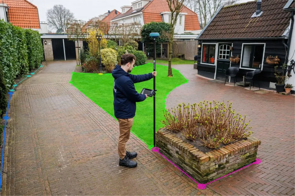
Set out the design
Paths, beds, sports fields and play areas straight from the drawing.
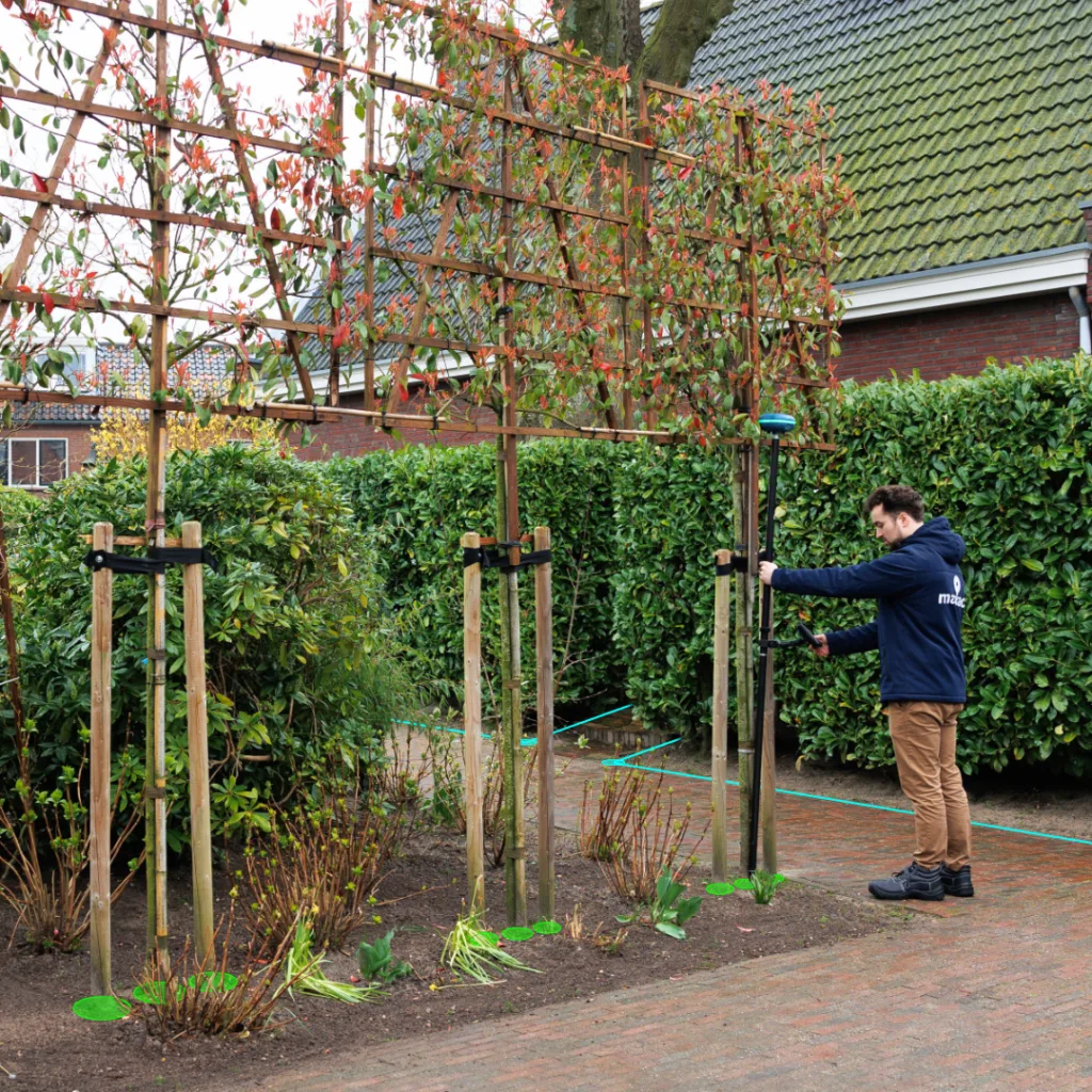
Record every object
Trees, benches, lighting and drainage to the centimetre, with photos.
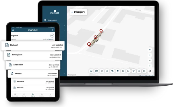
Hand over digitally
The client opens the result through a link, no software needed.
Trusted by 1000+ companies
More than 10 million objects measured, in more than 40 countries.











Green work, measured like civil work
Green spaces deserve the same digital as-built as roads and sewers. With the UNI-Collect Survey Package your crew sets out the design and records what was planted and built, with photos on every object. The result is in UNI-Cloud the same day.
Set out from the design
Photos on every object
Share through a link or QR code
What landscaping crews do with it
Design, construction and management of green spaces.
Set-out
- Paths, edges and planting beds.
- Sports fields and their markings.
- Play areas, fences and furniture.
Levels and drainage
- Levels for grading and turf.
- Falls for drainage and swales.
- Volume over a surface for soil and sand.
Recording
- Trees and their positions, with photos.
- Benches, lighting and signs.
- Areas of planting and paving.
Hand-over
- Export to DWG, DXF, CSV or GeoJSON.
- A public project link or QR code for the client.
- Reuse the plan for maintenance next season.
The kit for landscaping crews
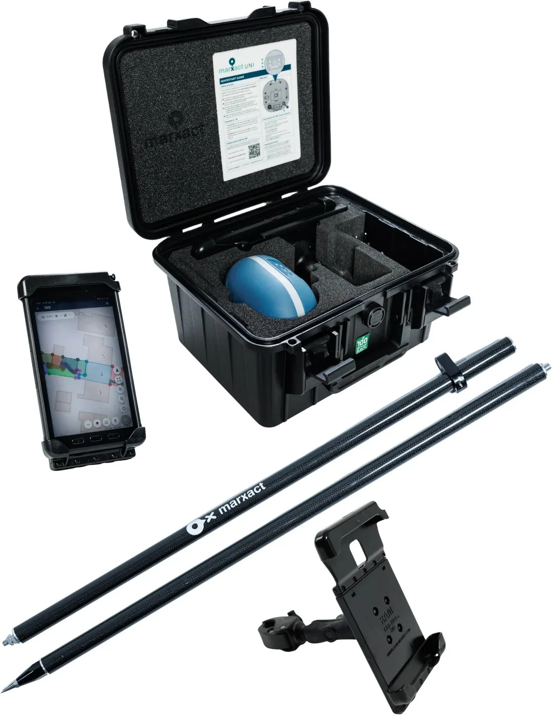
The UNI-Collect Survey Package: everything to set out and record green spaces in one case.
UNI-Collect Survey Package
| UNI-GR2 GNSS receiver | |
| UNI-Cloud Professional, 1 year* | |
| UNI-Collect app | Included |
| UNI-RTK Premium, 1 year* | |
| Samsung Galaxy Active Tab 5.0 | |
| 200 cm carbon survey pole | |
| RAM tablet mount |
Prefer to use your own tablet, or your own RTK service such as SAPOS or FLEPOS? Get the full price list to see what that takes off the price.
*UNI-Cloud Professional and UNI-RTK Premium are yearly subscriptions. Prices exclude VAT.
Add LiDAR capture with an iPad Pro.
KLIC notifications in the field and on the map
Your KLIC data sits in the same project as your measurements, in the field and in the office.
- Request a KLIC notification directly in UNI-Cloud.
- KLIC viewer as a layer over your project in UNI-Cloud.
- Open and download KLIC documents from UNI-Cloud.
- Use imported GeoJSON as a KLIC layer.
- Use KLIC codes in UNI-Collect on the tablet.
- Also visible in UNI-Machine in the cabin.
Available from UNI-Cloud Professional.
More when the job grows
Capture sites in 3D with the 3D Package, or grade larger areas with UNI-Machine on your excavator or dozer.
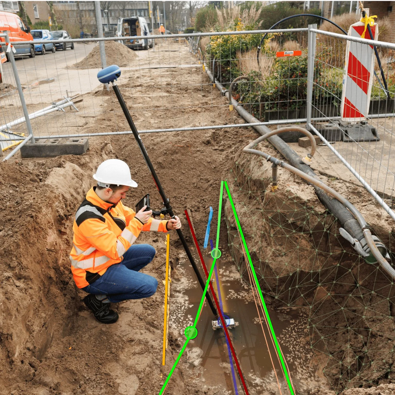
3D Package
Add LiDAR reality capture with an iPad Pro. Survey your own as-builts and capture trenches, facades and surroundings in 3D.
€ 6.990complete 3D package, excl. VAT
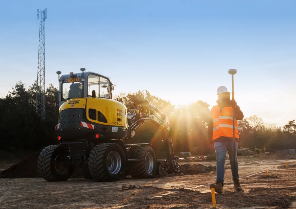
Machine Control
3D GPS machine guidance for excavators and dozers. Dig and grade straight to the design and cut rework on earthmoving jobs.
from € 17.995most common complete configuration, incl. first-year subscriptions, excl. VAT

Support that keeps you working
Our own support team in Hilversum answers the phone during office hours, on a local number in the Netherlands, Germany and the UK. Those three numbers are an extra, not a limit: we help customers worldwide, by phone, email and chat, in several languages. What customers tell us most is that we keep them moving. Someone picks up a kit from a colleague, has never used it before and calls to ask how to set it up: that is usually sorted on the phone in a few minutes. If talking it through is not enough, we can take over the receiver remotely and look at it with you. For the harder cases we stay on it until you can get on with your work.
- Email and chat support on every plan.
- Phone support and remote assistance from Professional.
- A replacement receiver if yours fails, on Ultimate.
What our customers say
“Measuring tapes are a thing of the past. With the UNI-GR2 we are now able to equip every worker, foreman or technician in the field with an easy to use receiver to survey.”
Heijmans
The Netherlands
“By using the UNI-GR2 and combining it with our GIS tools, we have been able to work more efficient. On fibre optics projects, we are now able to skip about 50 process steps!”

BAM Infra Telecom
The Netherlands
“The stake-out function saves us a lot of time, with quick loading of points and lines. It’s easy to use, which is a big plus. We use the UNI-GR2 for baseline measurements, construction work, and sewer projects, and we’re very satisfied with it.”
T. Van de Haterd
The Netherlands
Frequently asked questions
Yes. Load the design in the UNI-Collect app and set out edges, paths, beds and field markings to the centimetre, with a direction arrow to every point.
Yes. Record each tree, bench, light or sign as a point with its attributes and photos. Photos are placed on the receiver position, not on the tablet’s own GPS.
Centimetre-accurate with an RTK fix from the UNI-GR2 and UNI-RTK Premium corrections. In the open you work to the centimetre; close to buildings, trees or other obstructions, where the sky view is limited, expect around 2 cm. Tilt compensation up to 45 degrees means the pole does not have to be held level.
No. The kit is built for people on site without a surveying background. If you can use a smartphone, you can measure and set out with it. We walk you through the first setup, and our own support team in Hilversum is on the phone Monday to Friday, 09:00 to 17:00 CET.
The UNI-Collect Survey Package is € 5.645 the first year, complete with the UNI-GR2 receiver, a rugged tablet, a pole, the UNI-Collect app, one year of UNI-Cloud Professional and one year of UNI-RTK Premium. After that it is € 1.750 a year for the two subscriptions. Prices exclude VAT.
You choose the coordinate system per project: RD and NAP in the Netherlands, OSGB36 in the UK, Lambert in Belgium, the national grid and height system in Germany, or any other. Import CSV, TXT, DXF, DWG, LandXML, GeoJSON, KML and ESRI Shapefile; export DWG, DXF, LandXML, CSV, TXT and GeoJSON.
Want to see it in your green space?
Book a demo and we set out and record a few objects with you on your own site.
Or call us: +31 (0)70 700 7917