

Industries · Consultancy and research
Measure boreholes, sampling points and wells yourself
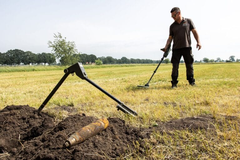
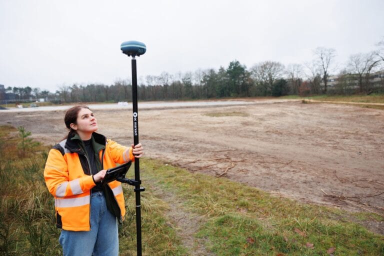
Boreholes, trial pits, sampling points and monitoring wells, measured to the centimetre by your own field team, and found again on the next visit. No surveyor needed.
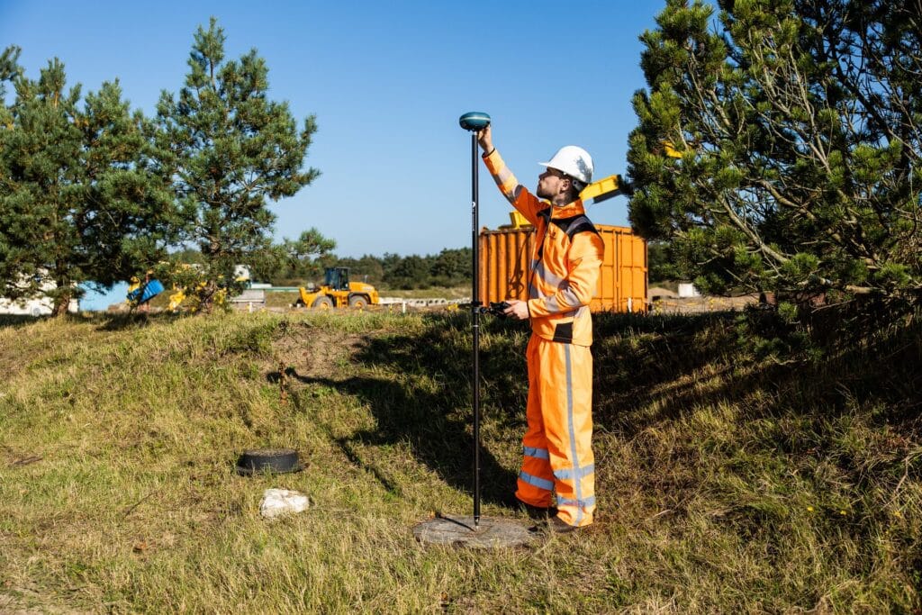
Measure as you drill
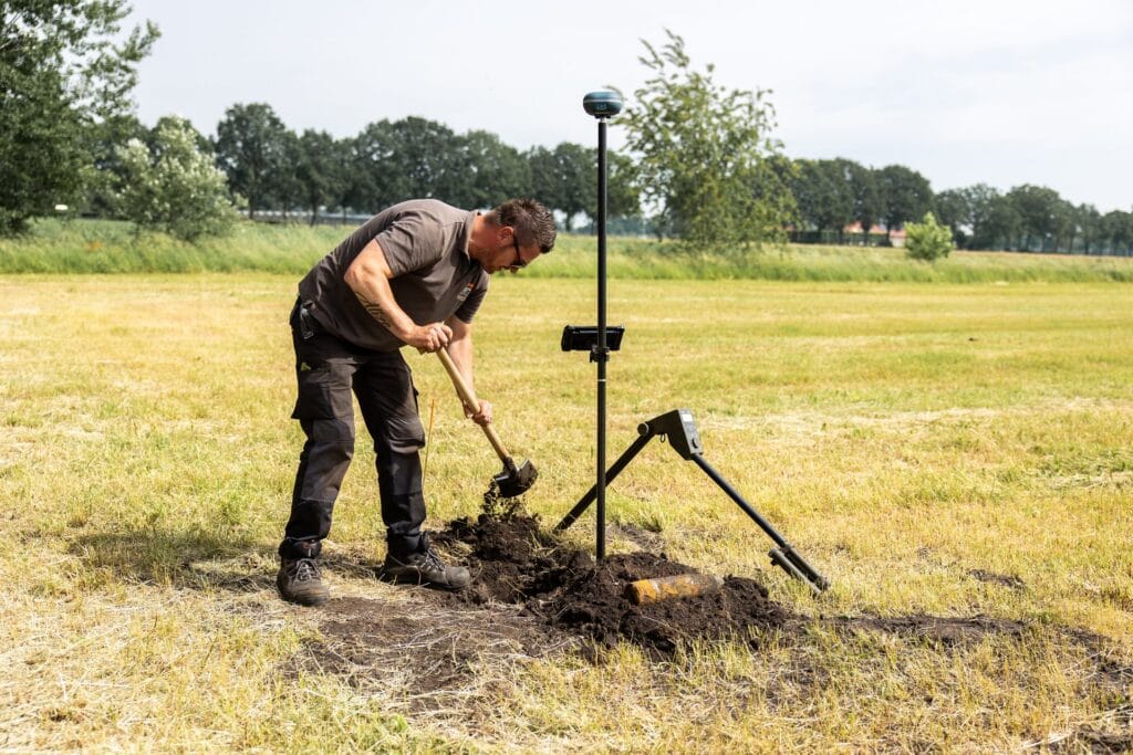
Every borehole and sampling point gets its position and height the moment it is made.
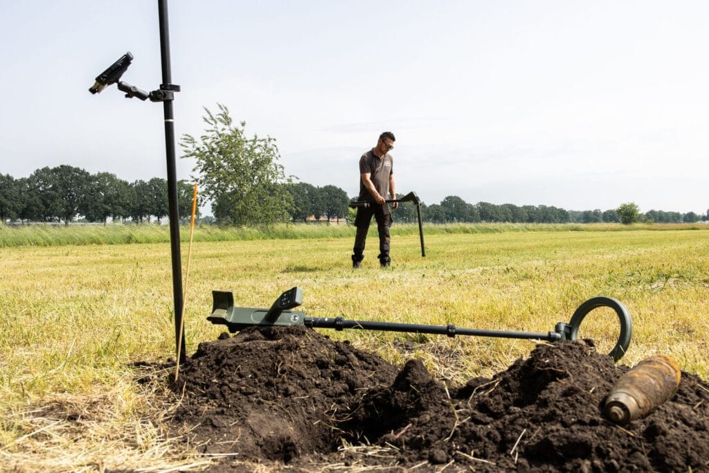
Find it again
Walk back to each well or sampling point on the next visit, with the direction arrow.
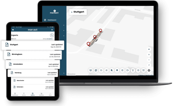
Deliver to the report
Positions, heights and photos in UNI-Cloud, exported for your GIS or report.
Trusted by 1000+ companies
More than 10 million objects measured, in more than 40 countries.








The same point, every round
A groundwater level or a settlement reading only means something on a known position and a reliable height. With the UNI-Collect Survey Package your field team measures each point to the centimetre as it is made and finds it again years later, without booking a surveyor. Fugro positions its soil investigation fieldwork with our equipment; read how Fugro works.
What consultants and researchers do with it
Soil investigation, environmental studies, monitoring and field research.
Baseline and sampling
- Baseline survey of the study area: levels, boundaries and what is there.
- Set out boreholes, sampling points and study plots from your plan.
- Cadastral parcel lines on the tablet in the Netherlands, Belgium and Germany.
Wells and monitoring
- Position and height of every well, sensor and settlement point.
- Heights against NAP or your own datum, without a separate levelling run.
- Photos on each point, on the receiver position.
Repeat measurements
- Walk back to the same point on every round.
- Adjust the sample grid and set out the new points.
- Every visit in one UNI-Cloud project.
Data for the report
- Import CSV, DXF, GeoJSON, KML and ESRI Shapefile.
- Export CSV, GeoJSON, DWG or DXF for your GIS.
- Connect the receiver over Bluetooth as position source in TerraIndex.
Terrain and pits
- Terrain levels for your model.
- Volume over a surface for excavations and stockpiles.
- Trial pits and trenches in 3D with the 3D Package.
Before and after fieldwork
- Request KLIC in UNI-Cloud before mechanical digging in the Netherlands.
- KLIC cables and pipes as a layer on the tablet.
- Measure the restored site at the end of fieldwork.
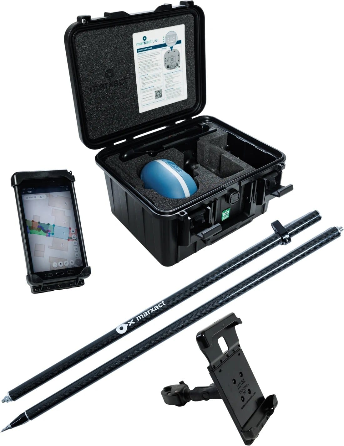
The kit for field teams
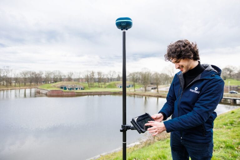
The UNI-Collect Survey Package: everything to measure and find your study points in one case.
UNI-Collect Survey Package
| UNI-GR2 GNSS receiver | |
| UNI-Cloud Professional, 1 year* | |
| UNI-Collect app | Included |
| UNI-RTK Premium, 1 year* | |
| Samsung Galaxy Active Tab 5.0 | |
| 200 cm carbon survey pole | |
| RAM tablet mount |
Prefer to use your own tablet, or your own RTK service such as SAPOS or FLEPOS? Get the full price list to see what that takes off the price.
*UNI-Cloud Professional and UNI-RTK Premium are yearly subscriptions. Prices exclude VAT.
Add LiDAR capture with an iPad Pro.
KLIC notifications in the field and on the map
Your KLIC data sits in the same project as your measurements, in the field and in the office.
- Request a KLIC notification directly in UNI-Cloud.
- KLIC viewer as a layer over your project in UNI-Cloud.
- Open and download KLIC documents from UNI-Cloud.
- Use imported GeoJSON as a KLIC layer.
- Use KLIC codes in UNI-Collect on the tablet.
- Also visible in UNI-Machine in the cabin.
Available from UNI-Cloud Professional.
More when the job grows
Capture trenches and test pits in 3D with the 3D Package, or move to UNI-Machine when your team also does earthworks.
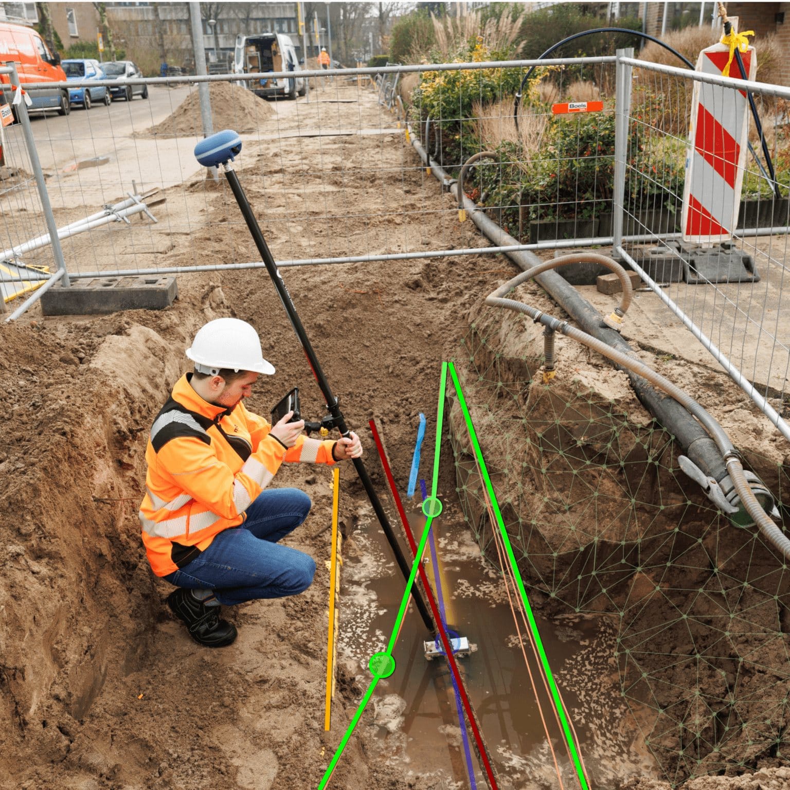
3D Package
Add LiDAR reality capture with an iPad Pro. Survey your own as-builts and capture trenches, facades and surroundings in 3D.
€ 6.990complete 3D package, excl. VAT

Machine Control
3D GPS machine guidance for excavators and dozers. Dig and grade straight to the design and cut rework on earthmoving jobs.
from € 17.995most common complete configuration, incl. first-year subscriptions, excl. VAT

Support that keeps you working
Our own support team in Hilversum answers the phone during office hours, on a local number in the Netherlands, Germany and the UK. Those three numbers are an extra, not a limit: we help customers worldwide, by phone, email and chat, in several languages. What customers tell us most is that we keep them moving. Someone picks up a kit from a colleague, has never used it before and calls to ask how to set it up: that is usually sorted on the phone in a few minutes. If talking it through is not enough, we can take over the receiver remotely and look at it with you. For the harder cases we stay on it until you can get on with your work.
- Email and chat support on every plan.
- Phone support and remote assistance from Professional.
- A replacement receiver if yours fails, on Ultimate.
What our customers say
“Measuring tapes are a thing of the past. With the UNI-GR2 we are now able to equip every worker, foreman or technician in the field with an easy to use receiver to survey.”

Heijmans
The Netherlands
“By using the UNI-GR2 and combining it with our GIS tools, we have been able to work more efficient. On fibre optics projects, we are now able to skip about 50 process steps!”

BAM Infra Telecom
The Netherlands
“The stake-out function saves us a lot of time, with quick loading of points and lines. It’s easy to use, which is a big plus. We use the UNI-GR2 for baseline measurements, construction work, and sewer projects, and we’re very satisfied with it.”

T. Van de Haterd
The Netherlands
Frequently asked questions
Yes. Every point is stored in UNI-Cloud with its coordinates and height. On the next visit you open the project and walk back to the point with the direction arrow and centimetre values, also when someone else measured it the first time.
Yes. Import the grid or plot layout as CSV, DXF, GeoJSON or KML and set out each point in the field with the UNI-Collect app. If you change the grid, import the new layout and the points are on the tablet as soon as it syncs.
Yes. Connect the UNI-GR2 over Bluetooth and select it as the position source in TerraIndex, so the borehole description and its position are recorded together. It also works on its own with the UNI-Collect app.
Yes. Export CSV, TXT, GeoJSON, DWG, DXF or LandXML, in 2D or 3D, per layer or the whole project. Import works the other way too: CSV, TXT, DXF, DWG, LandXML, GeoJSON, KML and ESRI Shapefile. Photos and attributes stay on each point.
The app works offline: projects and layers are on the tablet, and measurements sync to UNI-Cloud when there is a connection again. For the centimetre RTK fix the receiver needs a live correction stream, which the UNI-GR2 receives over its built-in 4G.
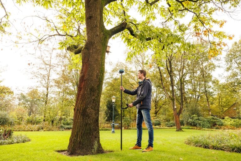
Centimetre-accurate with an RTK fix from the UNI-GR2 and UNI-RTK Premium corrections. In the open you work to the centimetre; close to buildings, trees or other obstructions, where the sky view is limited, expect around 2 cm. Tilt compensation up to 45 degrees means the pole does not have to be held level.
No. The kit is built for people on site without a surveying background. If you can use a smartphone, you can measure and set out with it. We walk you through the first setup, and our own support team in Hilversum is on the phone Monday to Friday, 09:00 to 17:00 CET.
The UNI-Collect Survey Package is € 5.645 the first year, complete with the UNI-GR2 receiver, a rugged tablet, a pole, the UNI-Collect app, one year of UNI-Cloud Professional and one year of UNI-RTK Premium. After that it is € 1.750 a year for the two subscriptions. Prices exclude VAT.
You choose the coordinate system per project: RD and NAP in the Netherlands, OSGB36 in the UK, Lambert in Belgium, the national grid and height system in Germany, or any other. Import CSV, TXT, DXF, DWG, LandXML, GeoJSON, KML and ESRI Shapefile; export DWG, DXF, LandXML, CSV, TXT and GeoJSON.
Want to see it on your own study site?
Book a demo and we measure a few points with you on your own site, next to your own drilling rig.
Or call us: +31 (0)70 700 7917