

Complete GPS surveying kit
Your own crew, setting out to the centimetre
One case with the receiver, tablet, app, cloud and corrections. Your groundworkers set out and record as-builts themselves, so the job does not wait for a surveyor.
Or ring us on +44 20 376 92580
Trusted by 1000+ companies
More than 10 million objects measured, in more than 40 countries.








Groundworks, utilities and highways
The same kit, on the three jobs UK crews use it for most. One case, one app, one project in the cloud.
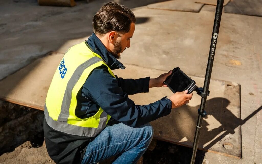
Groundworks
Set out foundations, drainage and levels straight from the drawing, and record what you built before it is covered up. The site agent has the as-built the same day.
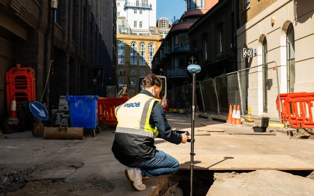
Utilities
Record ducting, chambers and cable routes as you lay them, with a photo on the point. Nobody has to come back to work out where it went.
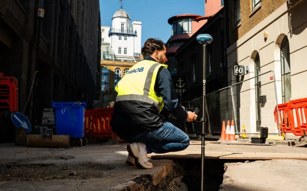
Highways
Set out kerb lines, ironwork and finished levels behind the barriers. No surveyor to book into a night shift or a lane closure.
Everything you need in one case
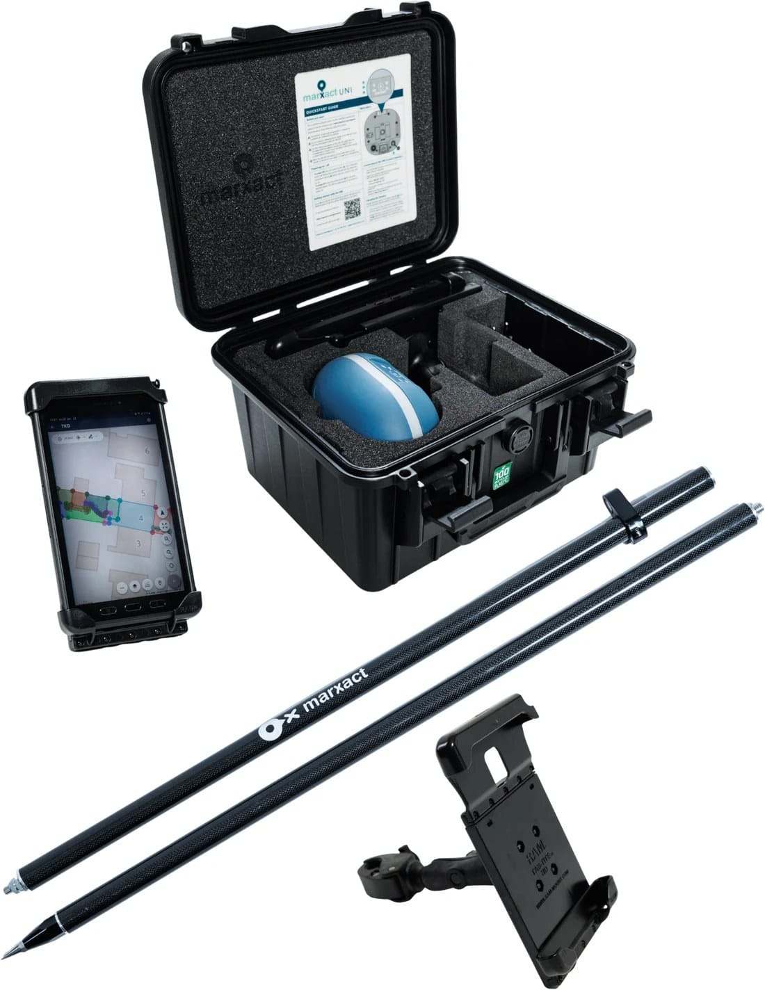
Receiver, tablet, app, cloud and corrections. Open the case and start setting out, no specialist needed.
UNI-Collect Survey Package
| UNI-GR2 GNSS receiver | |
| UNI-Cloud Professional, 1 year* | |
| UNI-Collect app | Included |
| UNI-RTK Premium, 1 year* | |
| Samsung Galaxy Active Tab 5.0 | |
| 200 cm carbon survey pole | |
| RAM tablet mount |
Prefer to use your own tablet? plus a year.
*UNI-Cloud Professional and UNI-RTK Premium are yearly subscriptions. Prices exclude VAT.
What the kit costs, next to hiring in
Everything the kit does, grouped
Survey, set out, import, export and share. What is not there yet is marked as such.
Measure
- Points, lines and areas, with offsets on all three.
- Enter a point by hand.
- Length in 2D and 3D, per segment and the angle to the previous one.
- Area, and volume over a surface.
- Averaging over a set recording time.
- Your own pole height, and tilt compensation up to 45 degrees.
Set out
- Points, lines and areas.
- A direction arrow to the target point.
- Values to the centimetre.
- A warning when accuracy drops.
- Save what you set out, or update the existing point.
Import and export
- In: CSV, TXT, DXF, DWG, LandXML, GeoJSON, KML and ESRI Shapefile, or a ZIP with a set of files.
- A full AutoCAD drawing with automatic layer mapping, names and colours kept.
- Out: DWG, DXF, LandXML, CSV, TXT and GeoJSON, in 2D or 3D, per layer or the whole project.
Background and reference data
- Large drawings as a fast background layer, in the field and in the cab.
- WMS layers supplied by us on Professional, your own source on Ultimate.
- A coordinate system per country, set when you create the project, with transformation grids on the tablet.
- Cadastral lines are available for the Netherlands, Belgium and Germany.
Photos and 3D
- Photos on a point or a shape, with EXIF, syncing on their own.
- LiDAR 3D scanning with an iPad Pro, with the UNI-GR2 for accuracy.
- Scans and photos on the map in UNI-Cloud, in a 3D viewer.
- Photos and scans land on the map on the centimetre, on the position of the UNI receiver, not on the tablet's own GPS.
Share and work together
- A public project link or a QR code, no account needed on the other side.
- Users, groups and rights, so a subcontractor sees only their own project.
- Real-time sync.
- An API and WebSockets for your own integration.
Coming soon: basic CAD drawing in UNI-Cloud. PDF reports are in the works.
Construction UK Magazine called it a game changer
Construction UK Magazine covered our UK launch and called the package a potential game changer for UK construction, because it lets contractors bring day-to-day surveying in-house instead of waiting for someone to become available.
The article puts the problem the way our customers do. A surveyor costs £500 to £1,000 a day, and the Royal Institution of Chartered Surveyors named the surveying shortage the most significant skills shortage in UK construction in its 2024 survey. Thirty minutes of training is enough to hand the kit to someone who is already on site.
Where all your field work comes together
Every point, line and project syncs to UNI-Cloud. Plan the work, share with the office and clients, and keep the field and the desk on the same page.
- Import and export CSV, AutoCAD, LandXML and GeoJSON
- Measure length, area and volume
- Share a project by link or QR code
UNI-Cloud Professional per user, per year.
Everyone who works in the project gets their own login. Included in the UNI-Collect Survey Package for the first year.
Draw straight in the cloud and send a finished PDF report to your client.
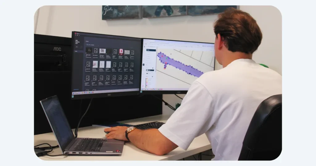
Import and export
Bring in CSV, TXT, DXF, DWG, LandXML, GeoJSON, KML or Shapefile, or a full AutoCAD drawing.
Projects
Set up layers and attributes once, use them in the field.
Real-time sync
Field data in the office the moment you save.
Share your results
A project link or a QR code for the client, and exports to DWG, DXF, LandXML, CSV, TXT or GeoJSON.
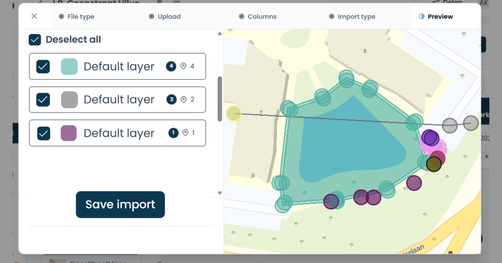
Layers and attributes
Set them up once in the office. In the field your crew picks them from a list, so every point lands in the right layer.
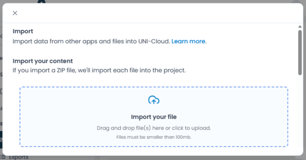
Drag and drop your files
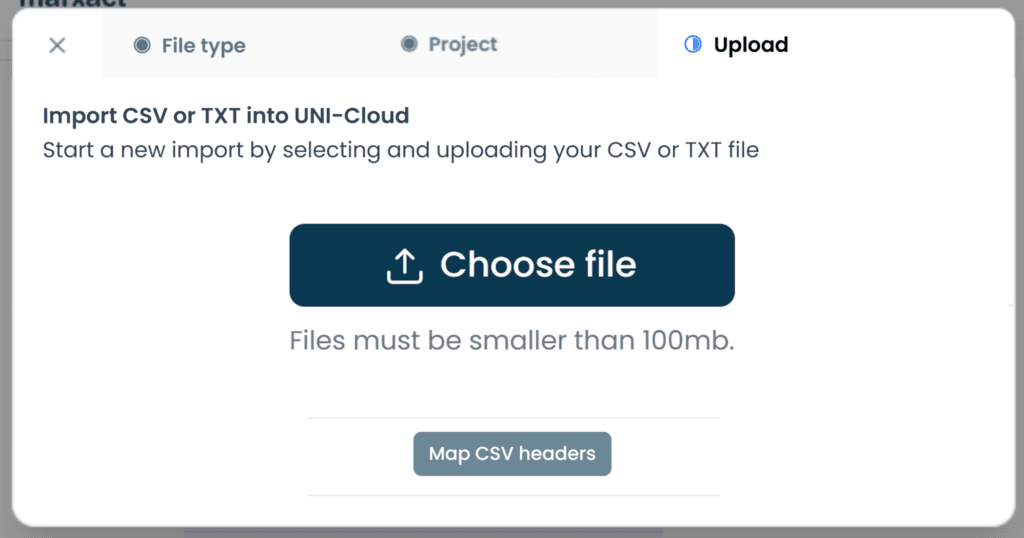
Drop a drawing or a point file straight into the project. It is on the tablet at the next sync.
Import and export
Bring in a CSV of coordinates and set out from it. Export your results to AutoCAD, CSV or LandXML.
The right kit for every job
From roads to fibre, utilities to green space: survey and set out to the centimetre, on any site.

Infrastructure
Set out and check roads, sewers and foundations right in the field.
Fibre optics
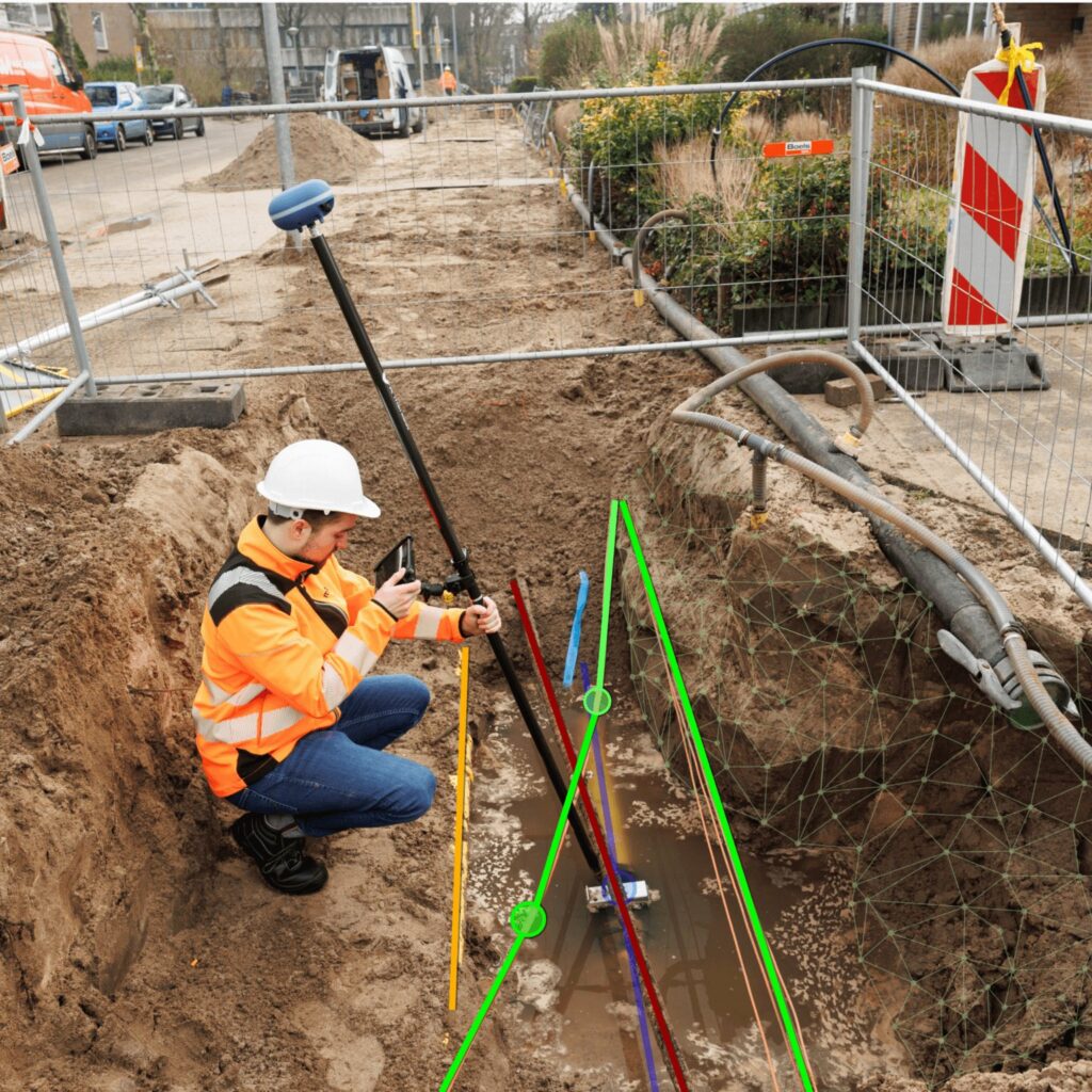
Map cables the moment they hit the trench and invoice the same day.

Utilities
Record gas, water and power to the centimetre for the energy transition.

Green
Design and set out gardens, parks and sports fields on site.
Events
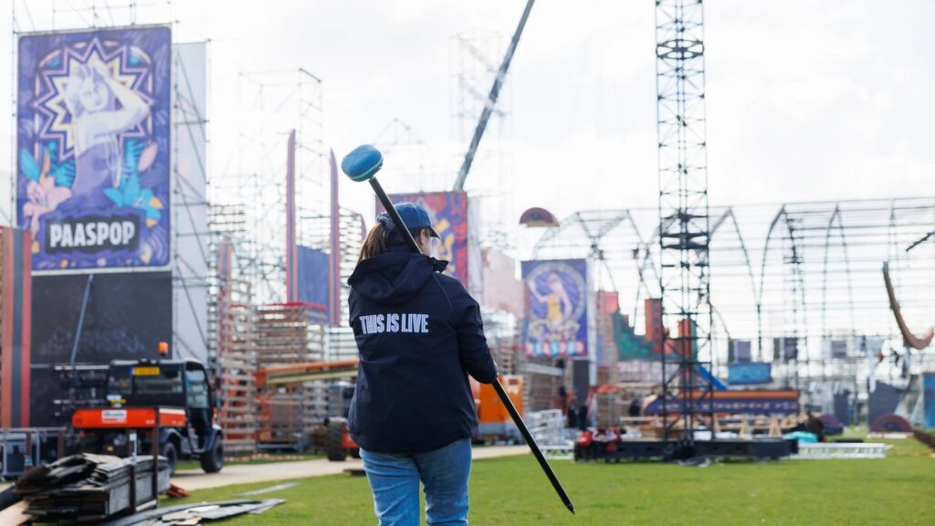
Set out stages, fences and cable runs, and reuse the same plan next year.

Support that keeps you working
Our own support team in Hilversum answers the phone during office hours, on a local number in the Netherlands, Germany and the UK. Those three numbers are an extra, not a limit: we help customers worldwide, by phone, email and chat, in several languages. What customers tell us most is that we keep them moving. Someone picks up a kit from a colleague, has never used it before and calls to ask how to set it up: that is usually sorted on the phone in a few minutes. If talking it through is not enough, we can take over the receiver remotely and look at it with you. For the harder cases we stay on it until you can get on with your work.
- Email and chat support on every plan.
- Phone support and remote assistance from Professional.
- A replacement receiver if yours fails, on Ultimate.
What our customers say
“Measuring tapes are a thing of the past. With the UNI-GR2 we are now able to equip every worker, foreman or technician in the field with an easy to use receiver to survey.”

Heijmans
The Netherlands
“By using the UNI-GR2 and combining it with our GIS tools, we have been able to work more efficient. On fibre optics projects, we are now able to skip about 50 process steps!”

BAM Infra Telecom
The Netherlands
“The setting-out function saves us a lot of time, with quick loading of points and lines. It’s easy to use, which is a big plus. We use the UNI-GR2 for baseline measurements, construction work and sewer projects, and we’re very satisfied with it.”

T. Van de Haterd
The Netherlands
Want to see it on your own site?
We set the kit up on your own job, with your own drawing, and let your crew use it while we are there.
Or ring us on +44 20 376 92580