Solución interna de topografía y replanteo para festivales, eventos al aire libre y mucho más.
Desde los escenarios hasta las zonas de seguridad, para que todos los elementos encajen a la perfección.
La confianza de los principales organizadores de eventos:


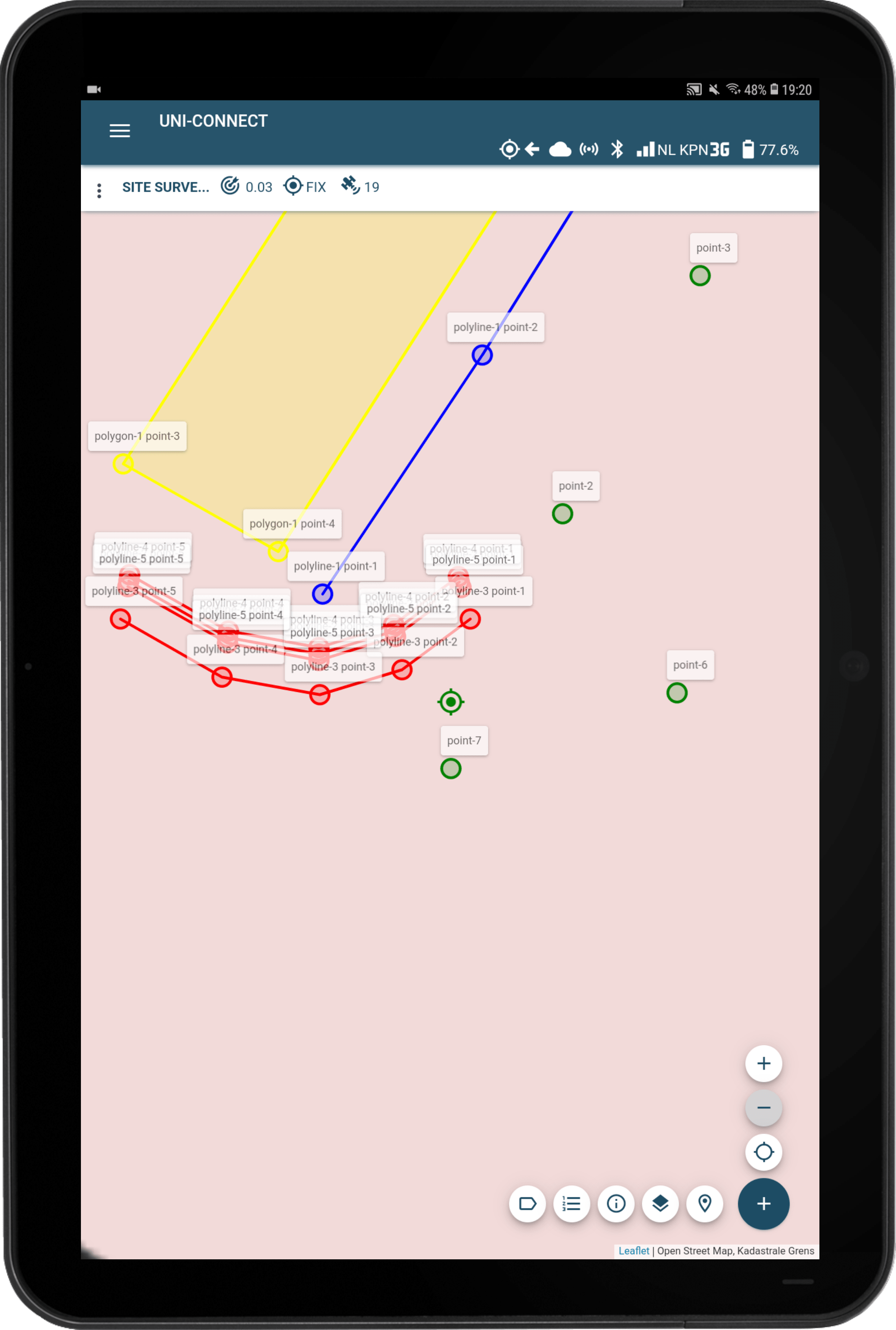
Con el paquete UNI-Collect Survey, podrá medir y replantear digitalmente el lugar de su evento con precisión RTK centimétrica.
Cada esquina del escenario, poste de la carpa, línea de la valla, zona del bar y zona de seguridad se posiciona según coordenadas exactas en lugar de adivinanzas. Esto elimina las discusiones in situ, reduce las costosas correcciones y garantiza un montaje más rápido y fluido, incluso con plazos ajustados.
Huellas y esquinas del escenario
Entre bastidores
Puestos FOH
Vallado y vías de control de multitudes
Zonas de emergencia y seguridad
Posiciones de los postes de la tienda
Esquinas de distribución del suelo
Entradas y vías de acceso
Zonas de tripulación y almacenamiento
Bares
Aseos
Puntos de agua
Camiones de comida y puestos de vendedores
Zonas de residuos
Lugares de primeros auxilios
Zonas de salida y llegada
Puntos de referencia de la ruta
Tribunas temporales
Posiciones de señalización
Los postes de las carpas, las esquinas del escenario, los bares y las zonas sanitarias reciben coordenadas precisas.
Trabaje con AutoCAD 3D, CSV, GeoJSON y otros formatos habituales.
Gracias al GNSS RTK y al posicionamiento por satélite, localice cada punto con precisión sobre el terreno.
Seleccione un punto en el mapa y siga las indicaciones hasta su ubicación exacta.
Rápido. Eficaz. Preciso. Sin incertidumbre.
¿LISTO PARA DIGITALIZAR EL MONTAJE DE SU EVENTO?
Recibir el folleto UNI-Complete
Programe una demostración gratuita in situ y vea UNI-Complete en acción
Obtenga asesoramiento experto, adaptado a sus necesidades específicas
La confianza de los líderes en organización de eventos:
Rellene sus datos y haga clic en enviar para ser redirigido a la página de descarga del ejemplo de dibujo AutoCAD, archivo CSV o informe PDF de los datos de su encuesta.