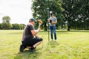
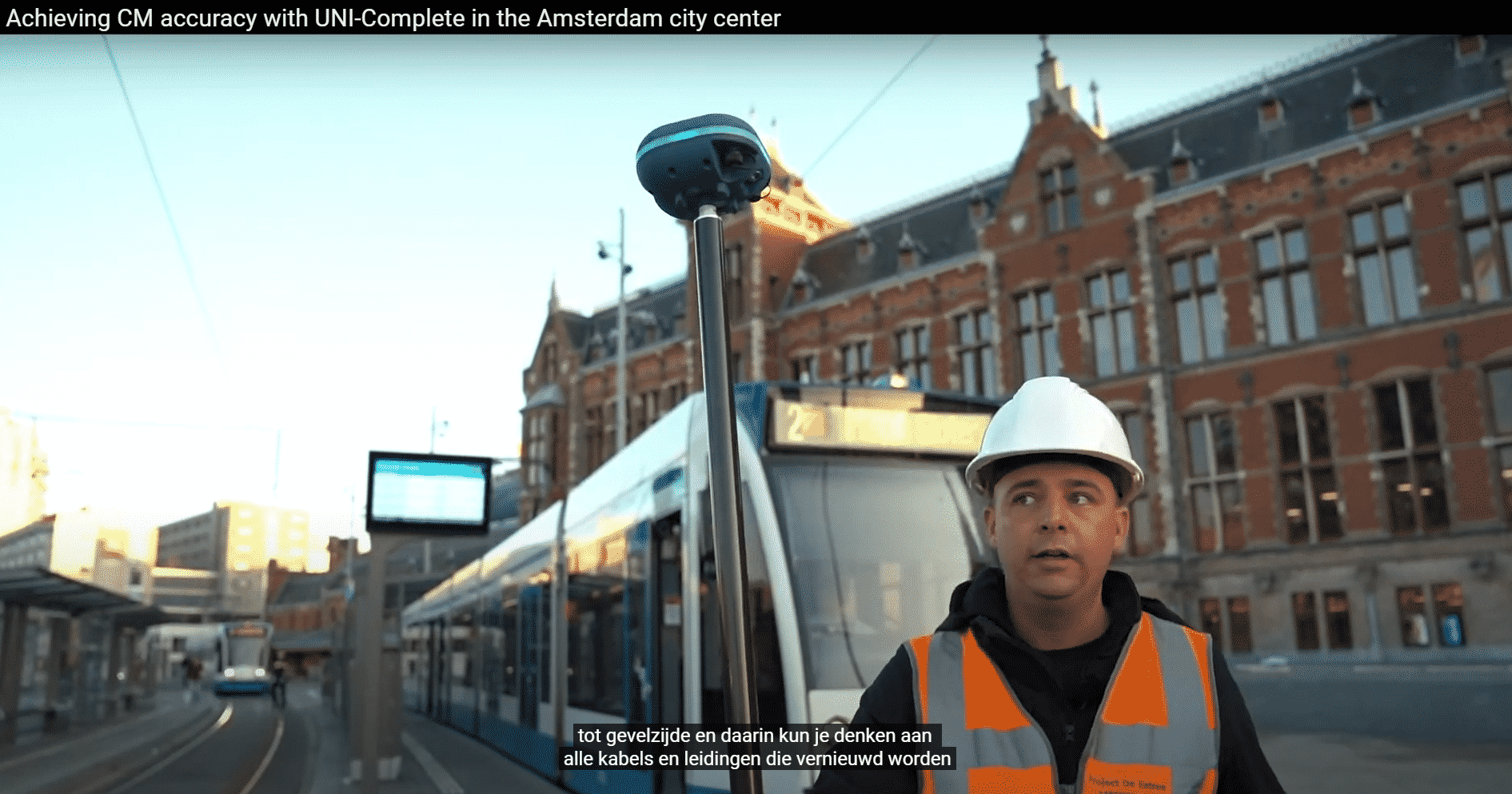
marXact makes centimetre accurate surveying easy and affordable for any fieldworker who knows how to use a smartphone
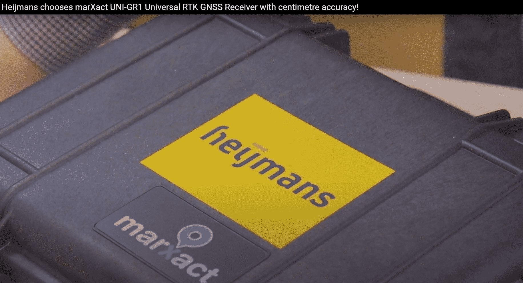
And we’re getting closer to that goal by the day. Take a look and see some of the organizations who have chosen for an easier way of surveying in the photos, read customer cases, or watch testimonial videos.
Kruse Groep
Uses the UNI-GR1 for all kinds of activities regarding (environmental) groundwork, as well as road and hydraulic engineering.
NTP
With the help of the UNI-GR1, NTP makes the environment more functional and sustainable on an infrastructure level.
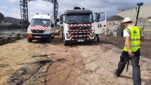
Aannemersbedrijf Lavèn
Active in water, road construction and earthworks, the UNI-GR1 helps them do their job.
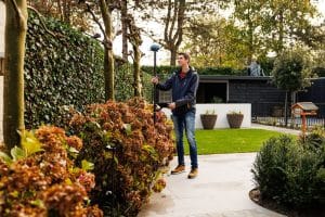
Hoveniersbedrijf Curatio
Rely on their UNI-GR1 for tailor-made advice, designs, and construction of gardens.
I.Deegen & Zn
The UNI-GR1 assists in carrying out demolition related work.
A. Jansen
Rely on their UNI-GR1 in the field of infrastructure, recycling and concrete related activities.
Atensus
Happy with their UNI-GR1 to remeasure their project drawings in the field.
Onderhoud Enschede
In order to keep the city of Enschede properly, they use the UNI-GR1 to get their accurate data.
You can find our users in almost any market segment
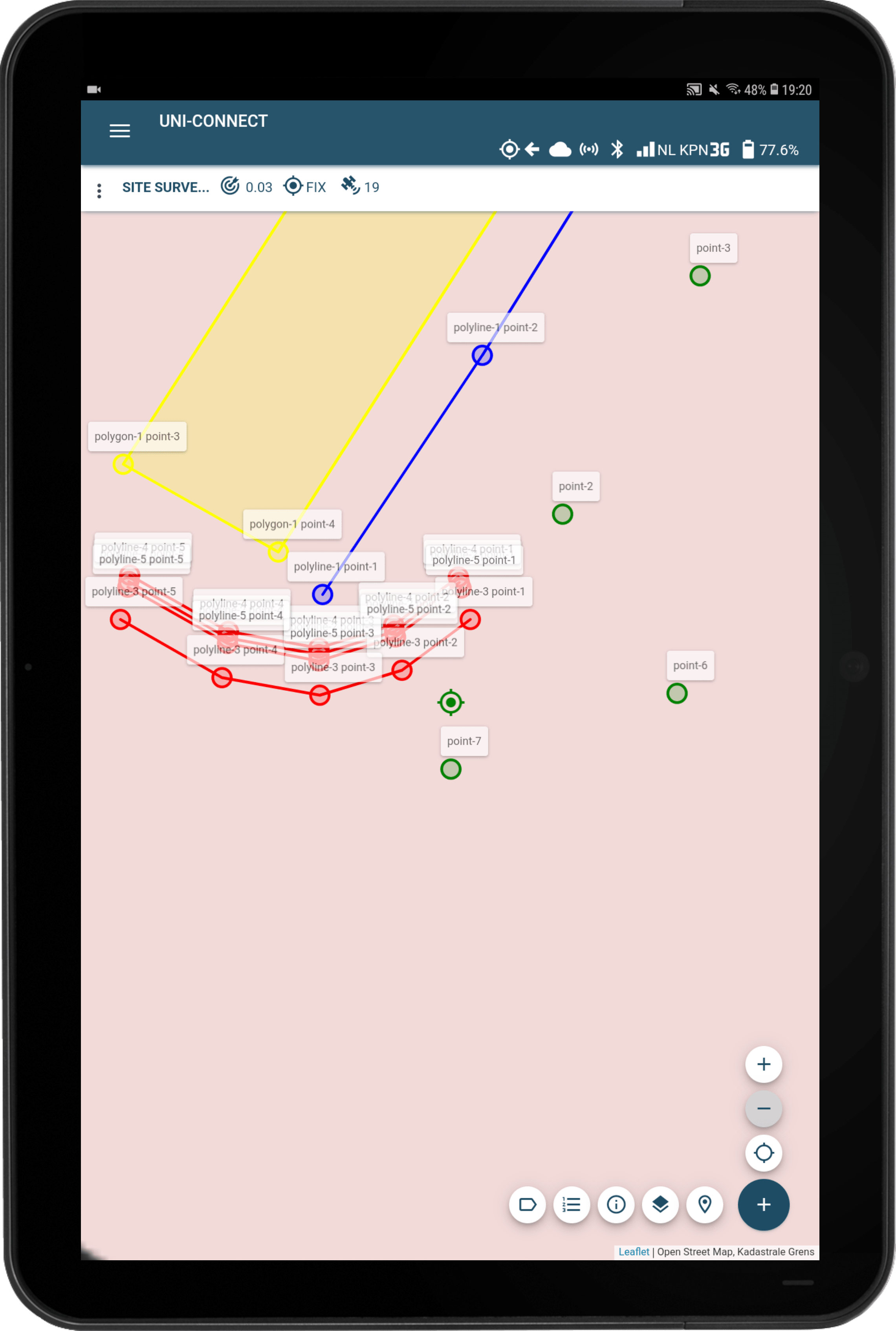
CM Accurate
X,Y,Z 3D Data
Points, Polylines, Polygons
Length, Surface, Perimeters
Ground control points Layers & Attributes
Location and Height Control
Stakeouts
Points, Polylines, Polygons
Complete Building, Road, Water, Infra Designs
Manual Coordinates
Point lists
Drawings Design Drawing Control
Design & As-Built
AutoCAD Drawings
PDF & CSV Reports
Open & amend design DXF
Design vs As-Built in field
Mix & Match
Measure new situation
Draw in the field
Any Discipline
Infra & construction
Water & Land
Roads & Waterways
Sewers, Telecom, Utility
Land, Gardens, Trees
Agriculture
Geospatial
Machinery
Mounted on a vehicle
Mounted on machine or UAV
Provide RTK base for Drones
Machine Control
Agriculture
Automatic Measuring
Measure areas fast
Interested in the benefits and applications?
Receive a brochure with all specifications and more information
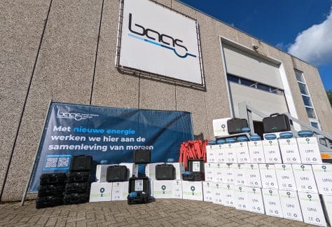
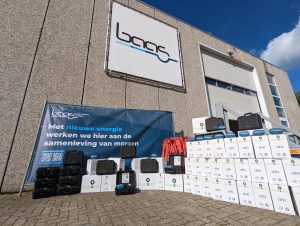
At a time when more and more clients make it mandatory to mark house connections on a map with precision, Baas B.V. embraced this development with full conviction. After a thorough research process in which several parties and combinations were considered, they opted for the combined forces of GOconnectIT and marXact.
These lucky winners won in earlier months and have therefore secured 3 months UNI-Cloud for free. Congratulations!
January
Hoveniersbedrijf Fons Linders
February
Point2Point Consultancy
March
Loonbedrijf Groeneveld
April
MV Tuinadvies
May
AVG Explosieven Opsporing Nederland
June
Roald Tuindesign
July
Rossing Geophysics
August
Knops Tuindesign
September
Direct Connect Telecom
October
DON Hoveniers
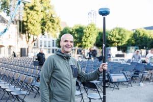
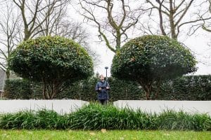
A selection of our users
EN
EN
NL
ES
DE
EN
EN
NL
ES
DE
Leaving already?
Why miss out on all the info?
Enter your email below and we'll set up a date and time for your free 15 minute phone call with a digital surveying expert. No strings attached!
Project Sample Download
Please fill in your details and click send to be redirected to the download page of the AutoCAD Drawing, CSV File or PDF Report example of your survey data.
We use cookies to personalise content and ads, to provide social media features and to analyse our traffic. We also share information about your use of our site with our social media, advertising and analytics partners who may combine it with other information that you’ve provided to them or that they’ve collected from your use of their services. Obviously all this data is anonymized.
This website uses cookies to improve your experience while you navigate through the website. Out of these cookies, the cookies that are categorized as necessary are stored on your browser as they are essential for the working of basic functionalities of the website. We also use third-party cookies that help us analyze and understand how you use this website. These cookies will be stored in your browser only with your consent. You also have the option to opt-out of these cookies. But opting out of some of these cookies may have an effect on your browsing experience.
Functional cookies help to perform certain functionalities like sharing the content of the website on social media platforms, collect feedbacks, and other third-party features.
Cookie
Duration
Description
bcookie
1 year
LinkedIn sets this cookie from LinkedIn share buttons and ad tags to recognize browser ID.
bscookie
1 year
LinkedIn sets this cookie to store performed actions on the website.
li_gc
5 months 27 days
Linkedin set this cookie for storing visitor's consent regarding using cookies for non-essential purposes.
lidc
1 day
LinkedIn sets the lidc cookie to facilitate data center selection.
UserMatchHistory
1 month
LinkedIn sets this cookie for LinkedIn Ads ID syncing.
Necessary cookies are absolutely essential for the website to function properly. These cookies ensure basic functionalities and security features of the website, anonymously.
Cookie
Duration
Description
__stripe_mid
1 year
Stripe sets this cookie cookie to process payments.
__stripe_sid
30 minutes
Stripe sets this cookie cookie to process payments.
_lfa
1 year 1 month 4 days
This cookie is set by the provider Leadfeeder to identify the IP address of devices visiting the website, in order to retarget multiple users routing from the same IP address.
_lfa_test_cookie_stored
less than a minute
No description
cookielawinfo-checkbox-advertisement
1 year
Set by the GDPR Cookie Consent plugin, this cookie is used to record the user consent for the cookies in the "Advertisement" category .
cookielawinfo-checkbox-analytics
11 months
This cookie is set by GDPR Cookie Consent plugin. The cookie is used to store the user consent for the cookies in the category "Analytics".
cookielawinfo-checkbox-functional
11 months
The cookie is set by GDPR cookie consent to record the user consent for the cookies in the category "Functional".
cookielawinfo-checkbox-necessary
11 months
This cookie is set by GDPR Cookie Consent plugin. The cookies is used to store the user consent for the cookies in the category "Necessary".
cookielawinfo-checkbox-others
11 months
This cookie is set by GDPR Cookie Consent plugin. The cookie is used to store the user consent for the cookies in the category "Other.
cookielawinfo-checkbox-performance
11 months
This cookie is set by GDPR Cookie Consent plugin. The cookie is used to store the user consent for the cookies in the category "Performance".
CookieLawInfoConsent
1 year
Records the default button state of the corresponding category & the status of CCPA. It works only in coordination with the primary cookie.
cookietest
session
No description
elementor
never
This cookie is used by the website's WordPress theme. It allows the website owner to implement or change the website's content in real-time.
m
1 year 1 month 4 days
No description available.
trp_language
1 month
No description available.
viewed_cookie_policy
11 months
The cookie is set by the GDPR Cookie Consent plugin and is used to store whether or not user has consented to the use of cookies. It does not store any personal data.
Performance cookies are used to understand and analyze the key performance indexes of the website which helps in delivering a better user experience for the visitors.
Cookie
Duration
Description
_uetsid
1 day
Bing Ads sets this cookie to engage with a user that has previously visited the website.
_uetvid
1 year 24 days
Bing Ads sets this cookie to engage with a user that has previously visited the website.
Analytical cookies are used to understand how visitors interact with the website. These cookies help provide information on metrics the number of visitors, bounce rate, traffic source, etc.
Cookie
Duration
Description
_ga
1 year 1 month 4 days
The _ga cookie, installed by Google Analytics, calculates visitor, session and campaign data and also keeps track of site usage for the site's analytics report. The cookie stores information anonymously and assigns a randomly generated number to recognize unique visitors.
_ga_*
1 year 1 month 4 days
Google Analytics sets this cookie to store and count page views.
_gat_UA-*
1 minute
Google Analytics sets this cookie for user behaviour tracking.
_gcl_au
3 months
Provided by Google Tag Manager to experiment advertisement efficiency of websites using their services.
_gid
1 day
Installed by Google Analytics, _gid cookie stores information on how visitors use a website, while also creating an analytics report of the website's performance. Some of the data that are collected include the number of visitors, their source, and the pages they visit anonymously.
AnalyticsSyncHistory
1 month
Linkedin set this cookie to store information about the time a sync took place with the lms_analytics cookie.
CONSENT
2 years
YouTube sets this cookie via embedded youtube-videos and registers anonymous statistical data.
ln_or
1 day
Linkedin sets this cookie to registers statistical data on users' behaviour on the website for internal analytics.
Advertisement cookies are used to provide visitors with relevant ads and marketing campaigns. These cookies track visitors across websites and collect information to provide customized ads.
Cookie
Duration
Description
_fbp
3 months
This cookie is set by Facebook to display advertisements when either on Facebook or on a digital platform powered by Facebook advertising, after visiting the website.
IDE
1 year 24 days
Google DoubleClick IDE cookies are used to store information about how the user uses the website to present them with relevant ads and according to the user profile.
MUID
1 year 24 days
Bing sets this cookie to recognize unique web browsers visiting Microsoft sites. This cookie is used for advertising, site analytics, and other operations.
test_cookie
15 minutes
The test_cookie is set by doubleclick.net and is used to determine if the user's browser supports cookies.
VISITOR_INFO1_LIVE
5 months 27 days
A cookie set by YouTube to measure bandwidth that determines whether the user gets the new or old player interface.
YSC
session
YSC cookie is set by Youtube and is used to track the views of embedded videos on Youtube pages.
yt-remote-connected-devices
never
YouTube sets this cookie to store the video preferences of the user using embedded YouTube video.
yt-remote-device-id
never
YouTube sets this cookie to store the video preferences of the user using embedded YouTube video.
yt.innertube::nextId
never
This cookie, set by YouTube, registers a unique ID to store data on what videos from YouTube the user has seen.
yt.innertube::requests
never
This cookie, set by YouTube, registers a unique ID to store data on what videos from YouTube the user has seen.

