What is the difference between Standalone, Differential GPS and Real-time Kinematic?
Did you know everyone could survey and perform stakeouts with GPS?
Read more about the UNI-GR1, a universal RTK GNSS Receiver. Digital surveying and performing stakeouts is now easier than ever. Available in a complete package and ready to use worldwide. Want to know more? Click here
This article explains the differences and corresponding accuracy between a standalone GNSS receiver, differential GPS and Real-time Kinematic (RTK).
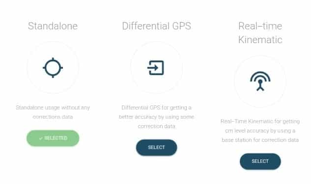
Standalone, Single Point Positioning or Standard GNSS
Standalone is the standard GNSS practice, also known as Single Point Positioning. While using this method, there are no error corrections made. The GNSS satellites just provide you with the best standard signals available. The UNI-GR1 will have an accuracy around 1.5 meters.
Differential GNSS or DGPS
Differential GPS/GNSS or DGPS/DGNSS is essentially a system to provide positional corrections to regular GPS/GNSS signals. DGPS uses bases with a fixed known position to adjust real time GPS signals to eliminate errors. These DGPS corrections improve the accuracy of the Standalone position data. The UNI-GR1 makes distance measurements in real time to each satellite in use. The difference between the known and measured range for each satellite is the range error. This error is the amount that needs to be removed from each satellite distance measurement. The base-station transmits the range error corrections to the UNI-GR1 in real-time. The UNI-GR1 corrects it's satellite range measurements using these differential corrections, giving a much more accurate position. The UNI-GR1 provides a horizontal accuracy of maximum 40 centimeters while using DGPS. The advantage of DGPS is that it is useful over a longer baseline and it’s usually less expensive than RTK.
Real-Time Kinematic (RTK)
The idea of differential GPS and RTK are quite similar. Both methods require a base-station receiver setup at a known location and a rover that gets the corrections from the base-station or a network of base stations (UNI-RTK Premium). There is always a live communications link between the rover and the base station needed to receive these corrections. When the errors are corrected, errors such as ionospheric and satellite clock errors are removed and the UNI-GR1 gets to centimetre level accuracy. RTK is significantly more accurate than DGPS due to improved techniques and can be used for applications that require a higher accuracy, like surveying.